×
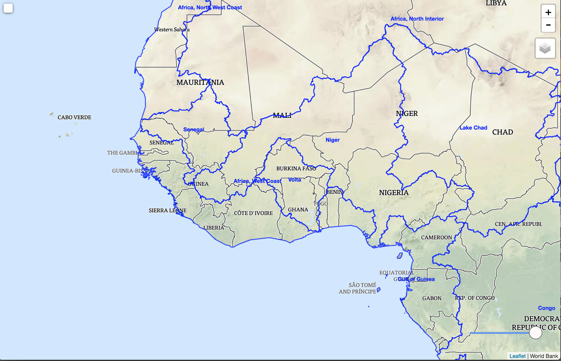
West Africa Coastal Areas (WACA) Program e-Atlas
All
Environmental
Economic
Climate
Hydrology
Disasters
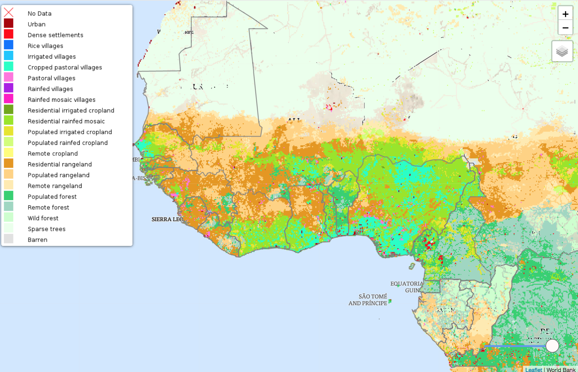
Landsat Vegetation Analysis
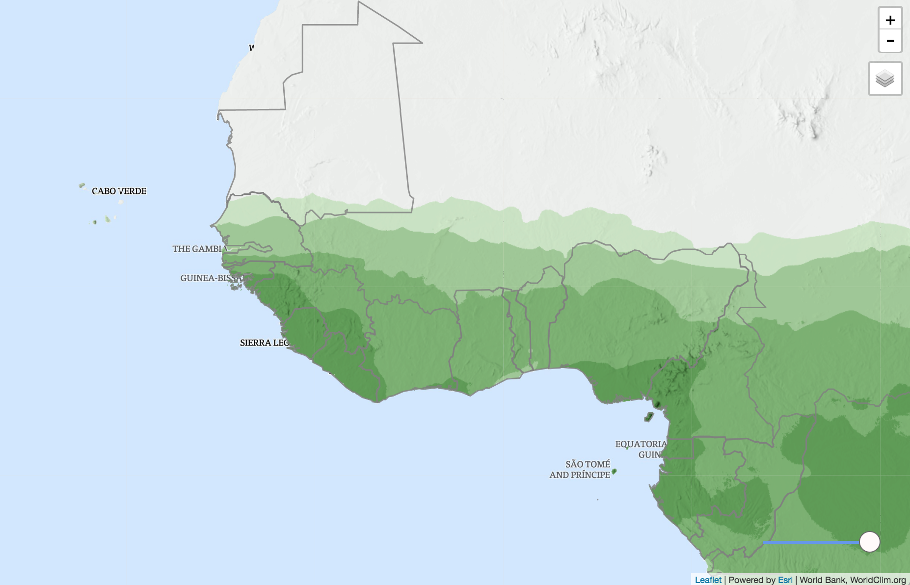
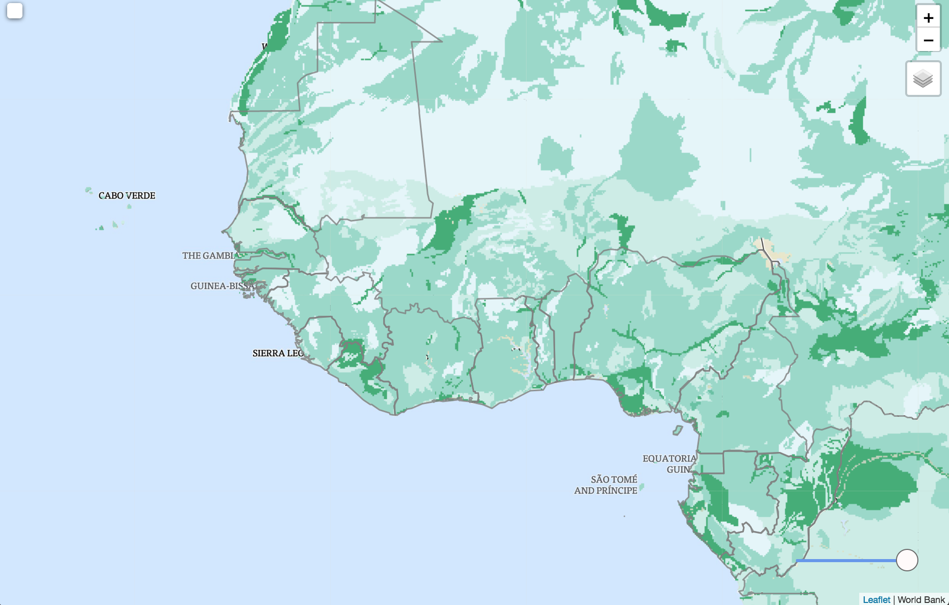
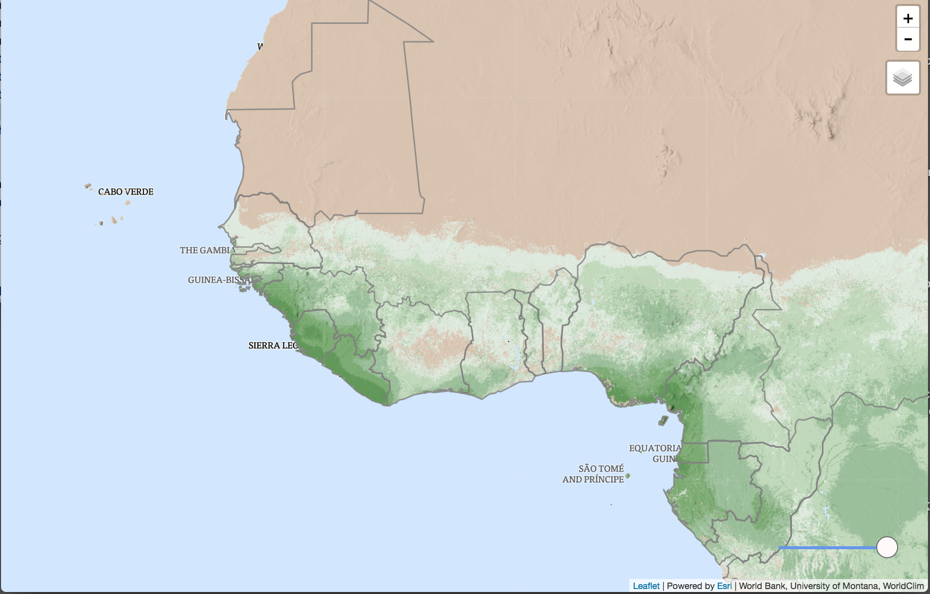
Biomes
Biomass
Protected Areas
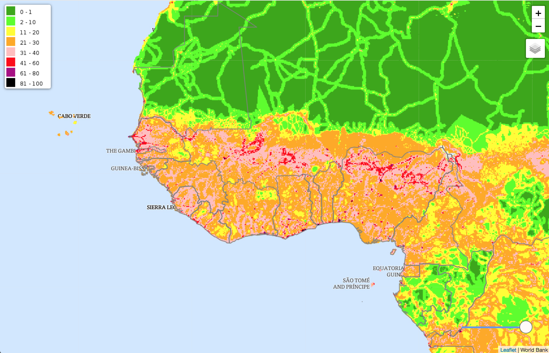
Human Footprint
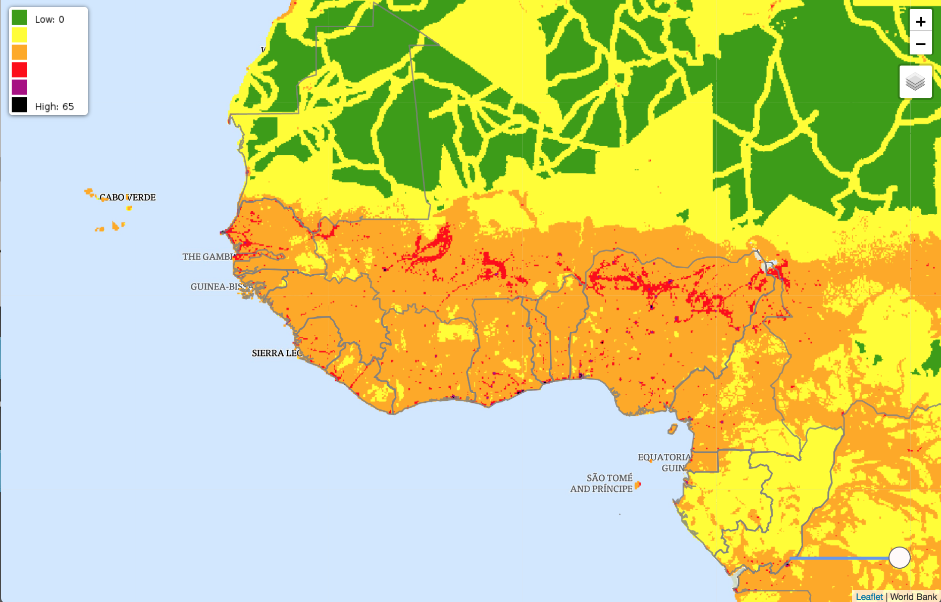
Human Influence Index
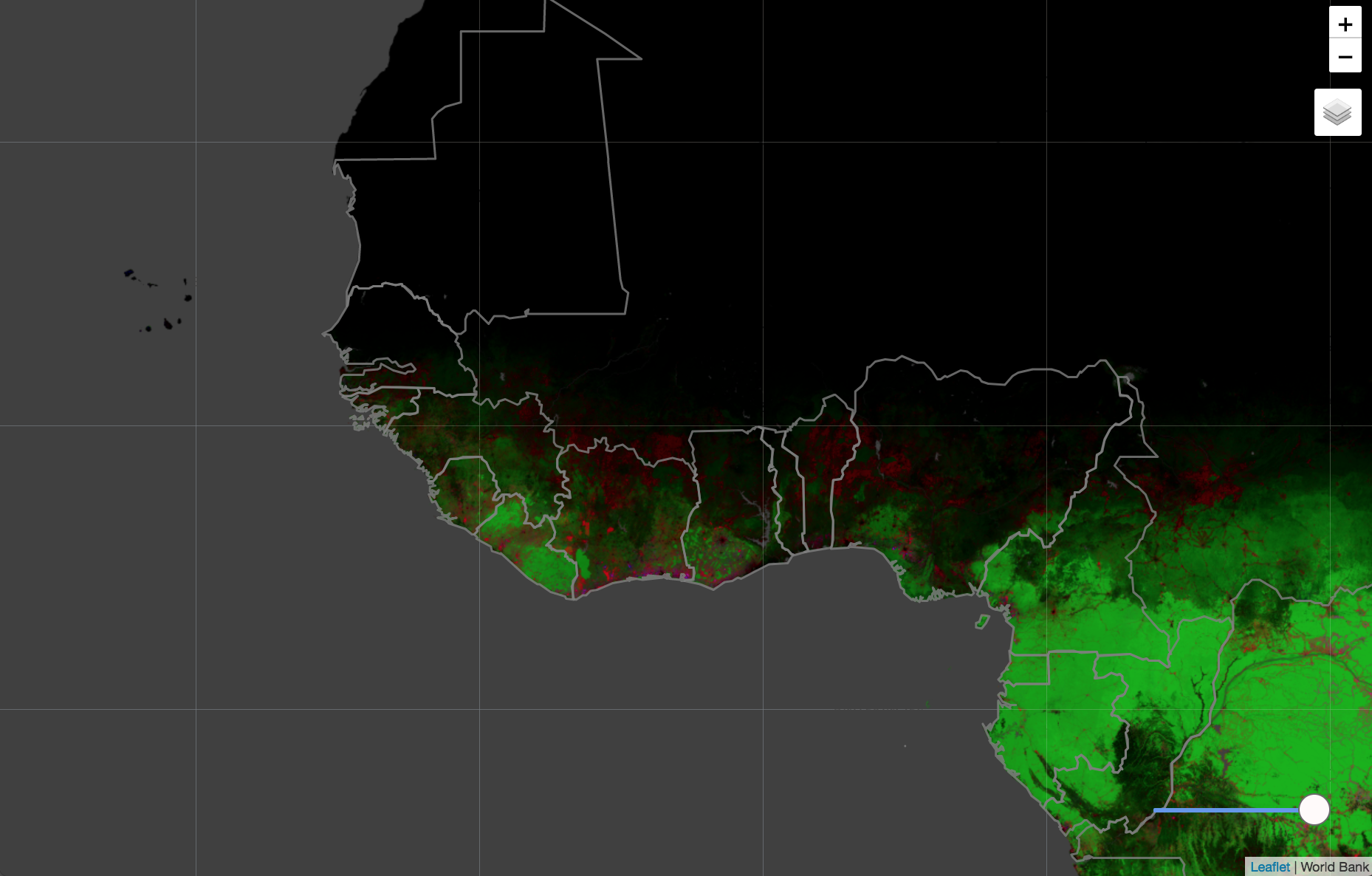
Forest Loss/Extent/Gain
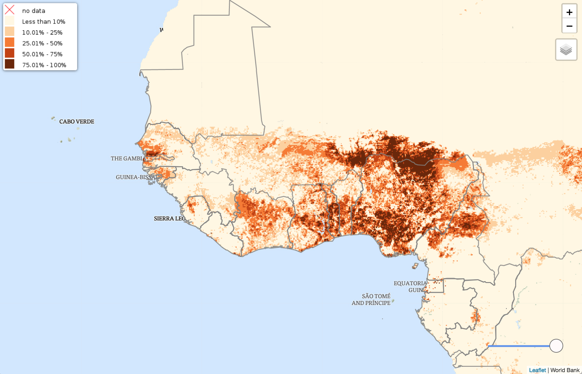
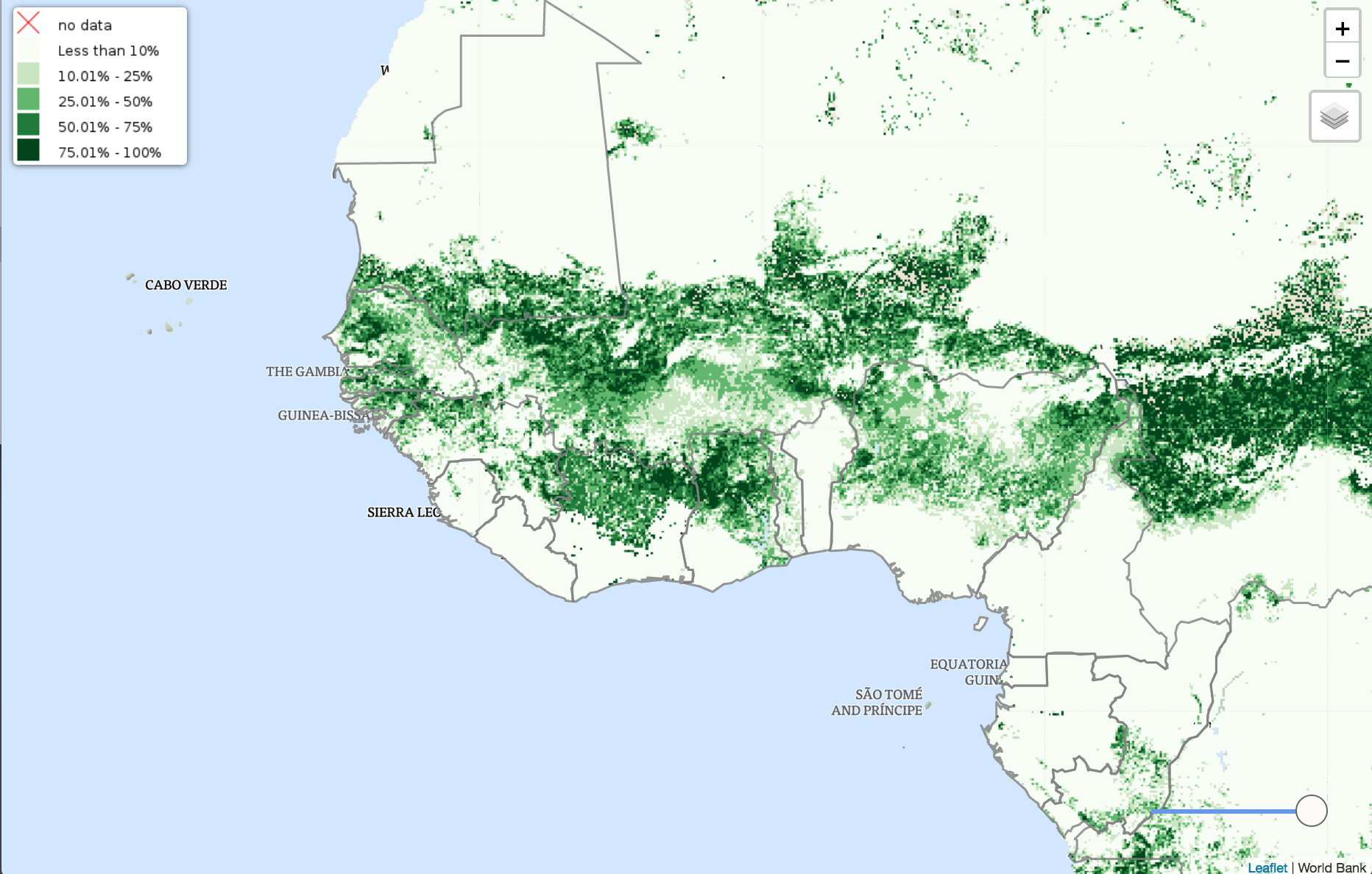
Crop Land
Pasture
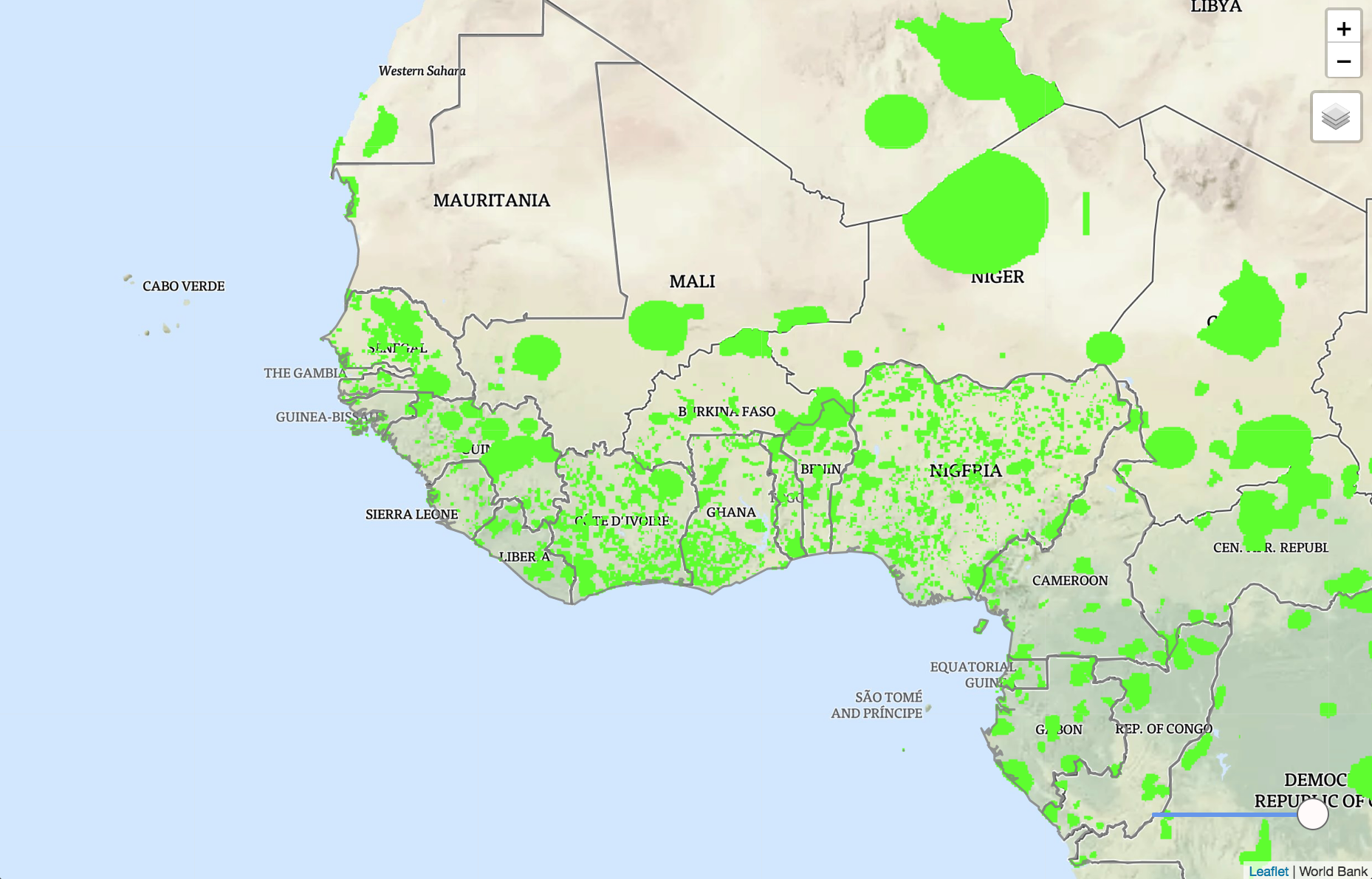
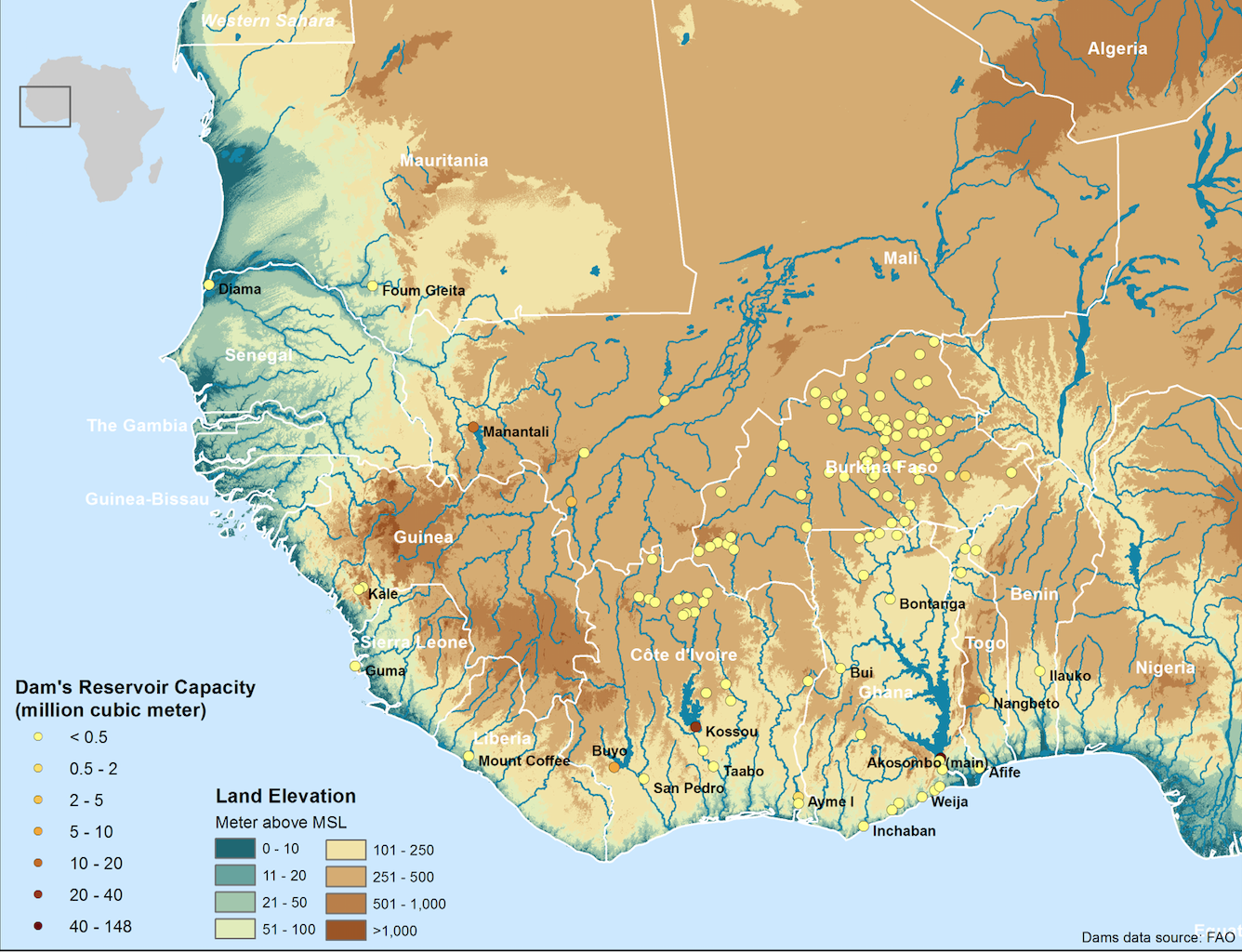
Dams
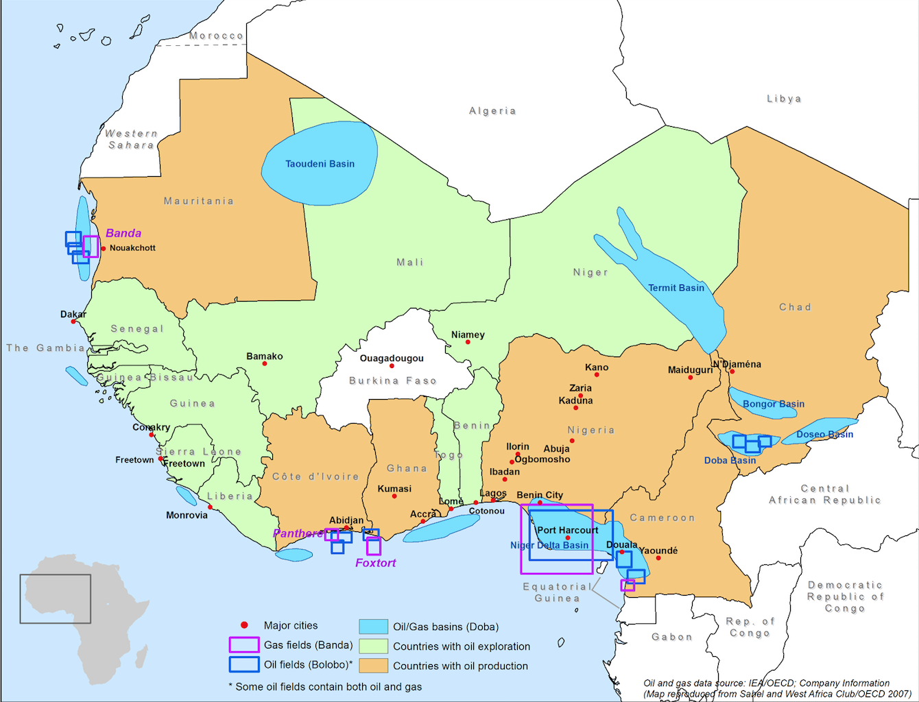
Oil and Gas Fields
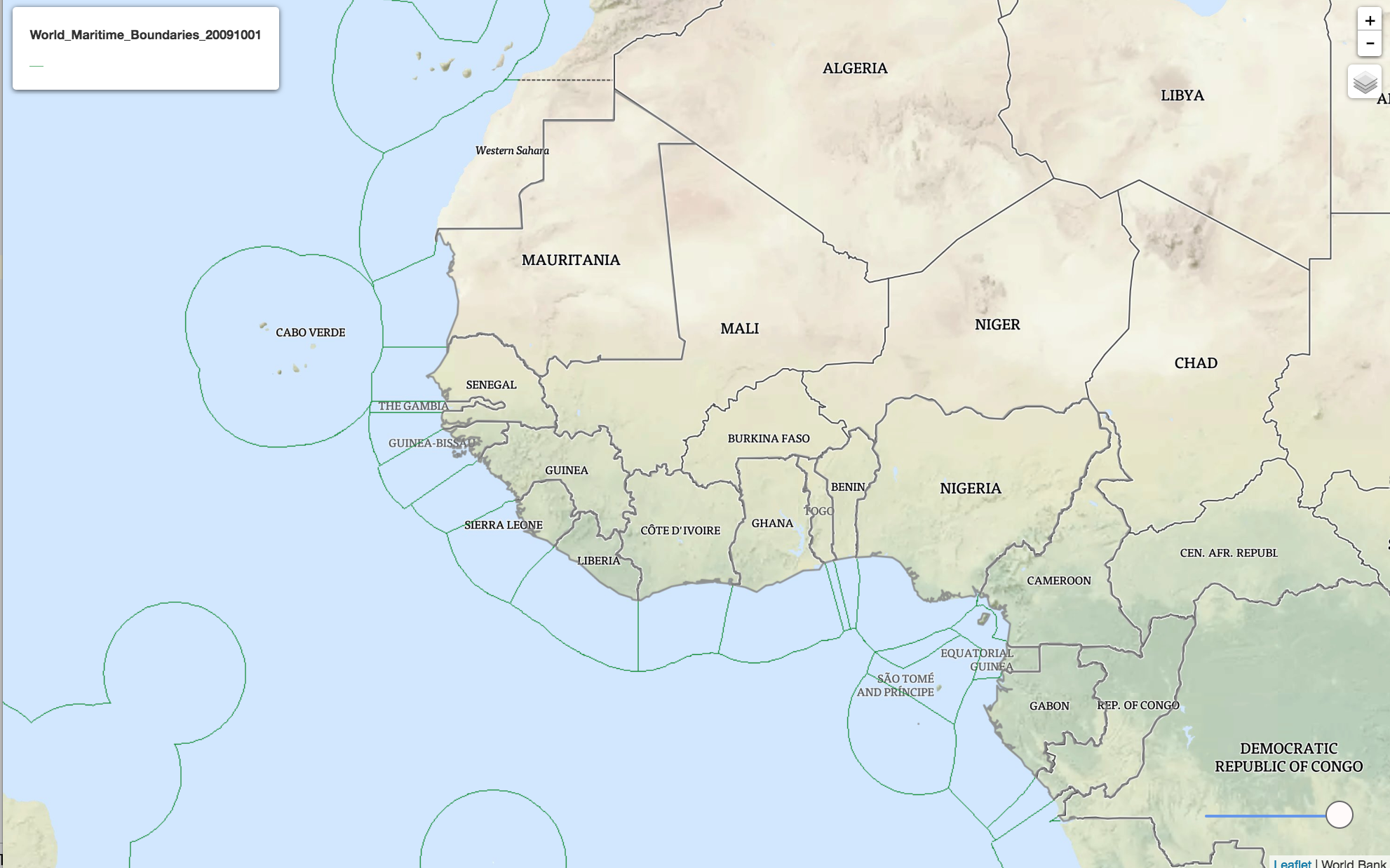
Maritime Borders
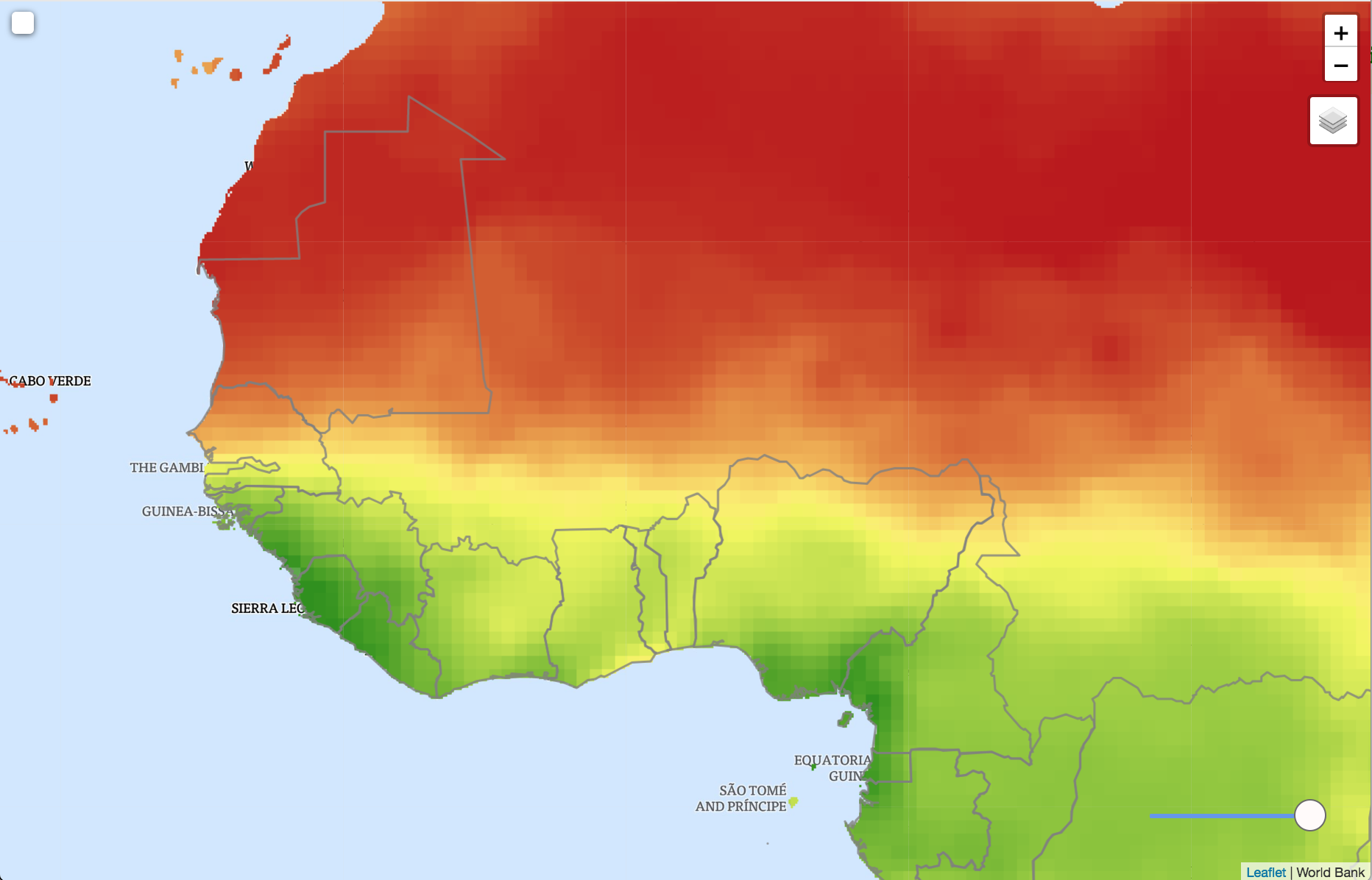
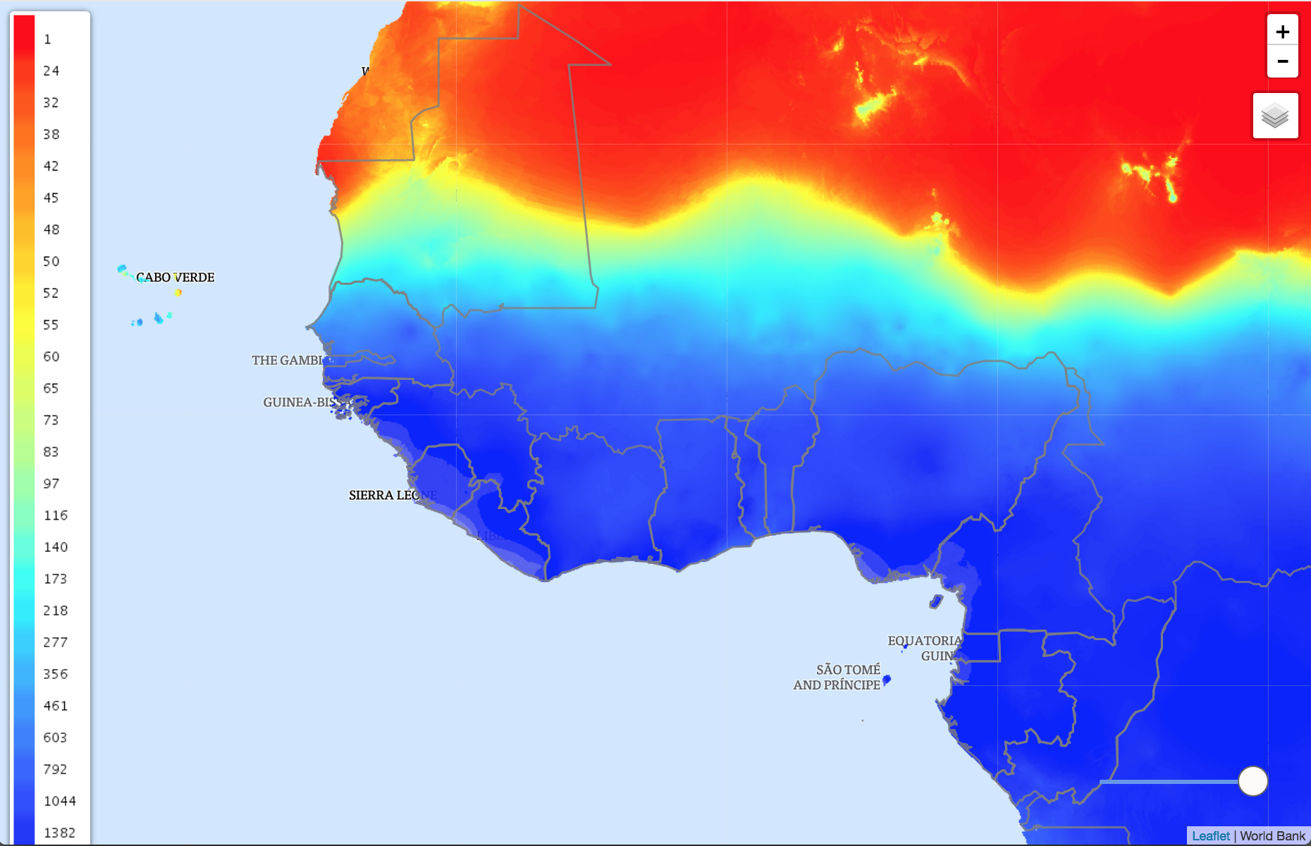
Annual Average Precipitation
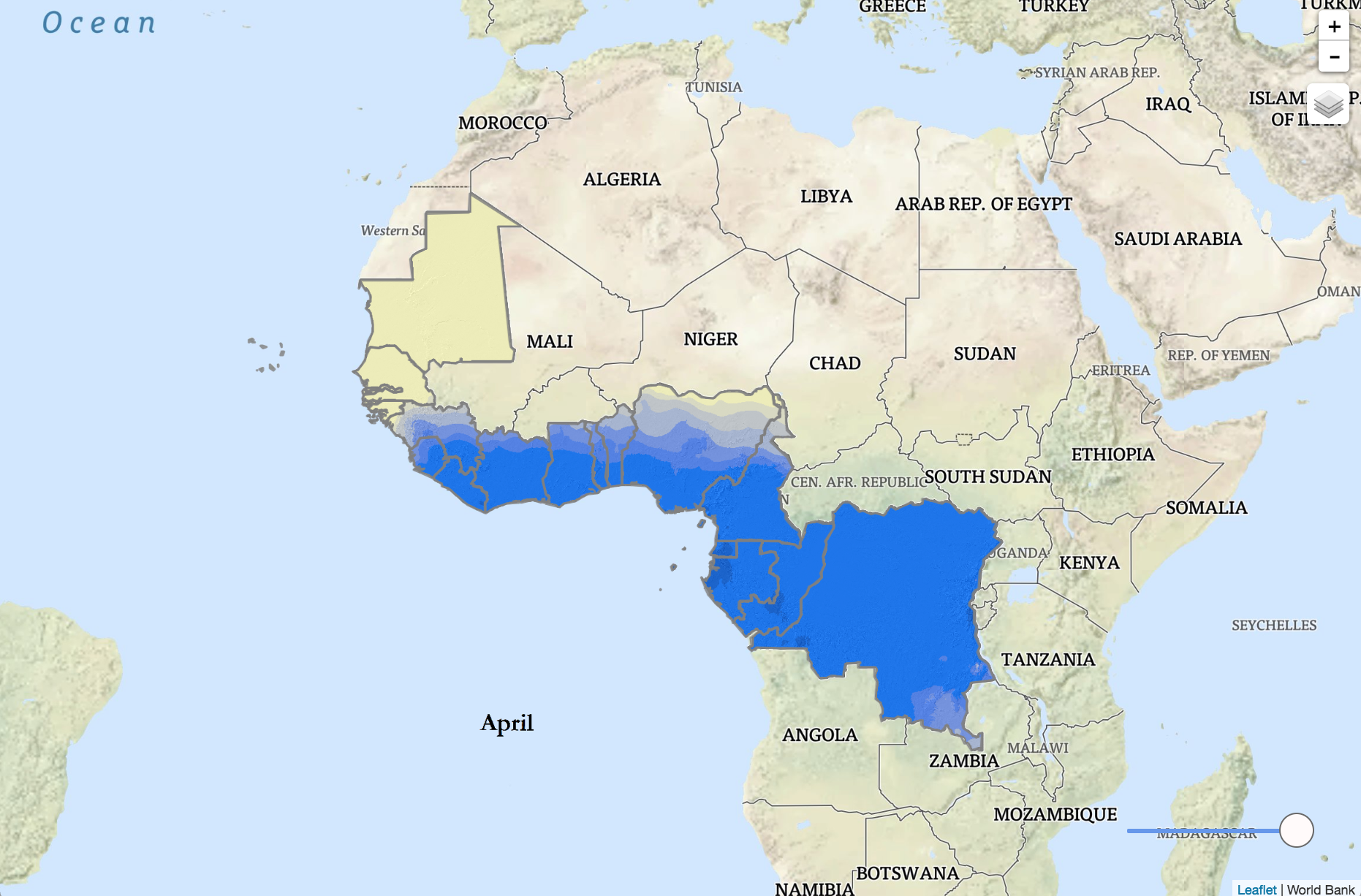
Average Monthly Precipitation
Historical Precipitation
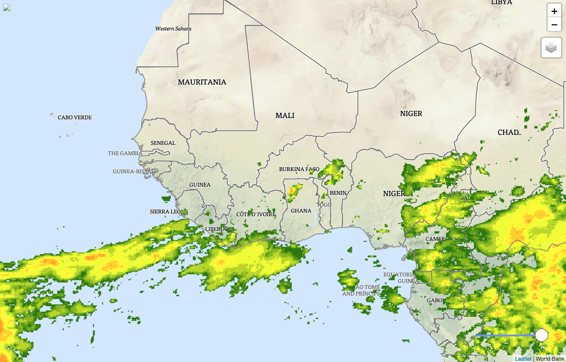
Precipitation Accumulation
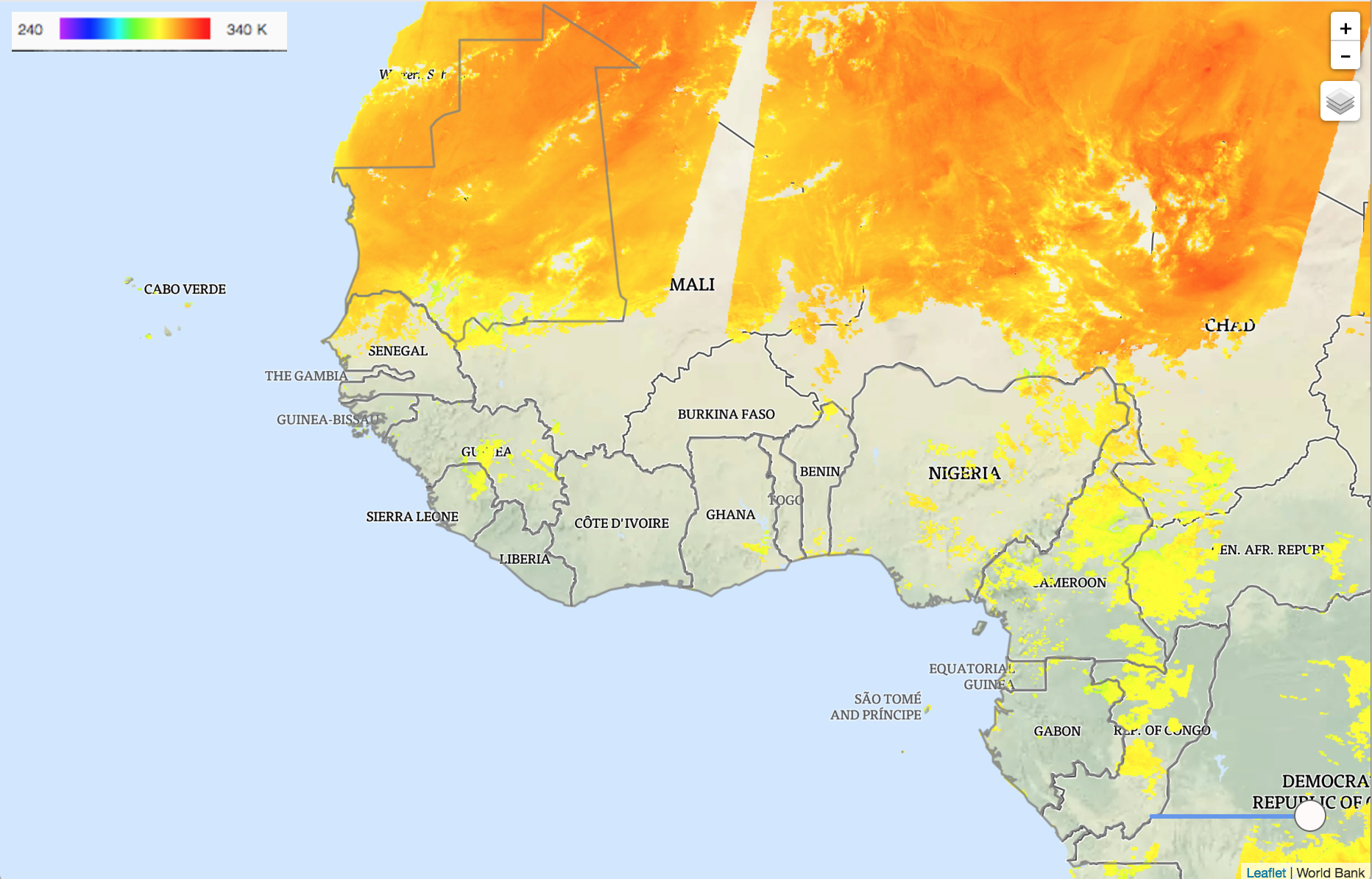
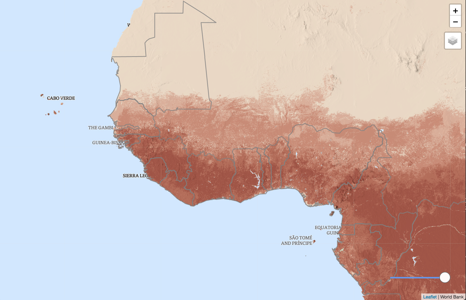
Land Surface Temperature
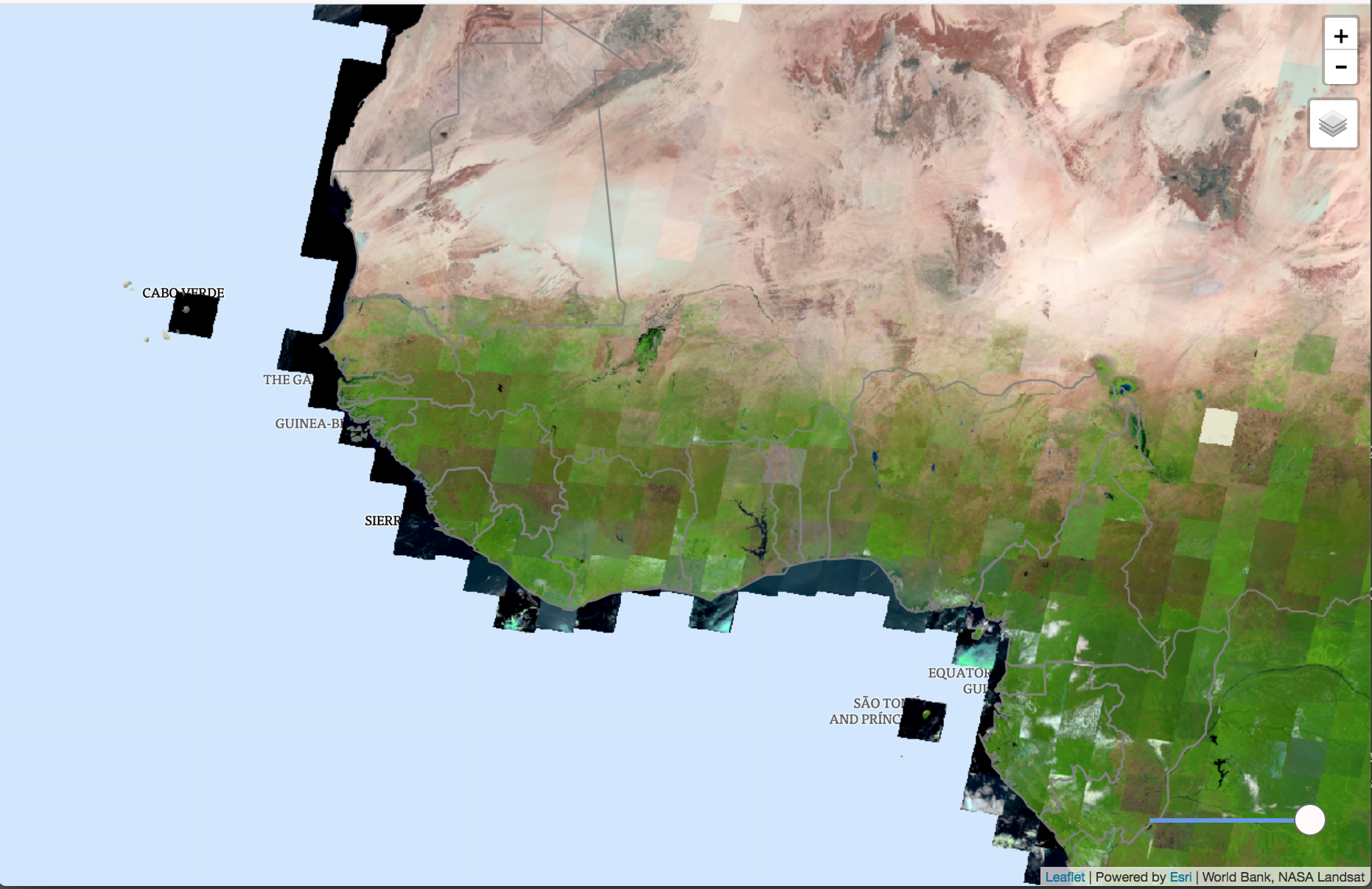
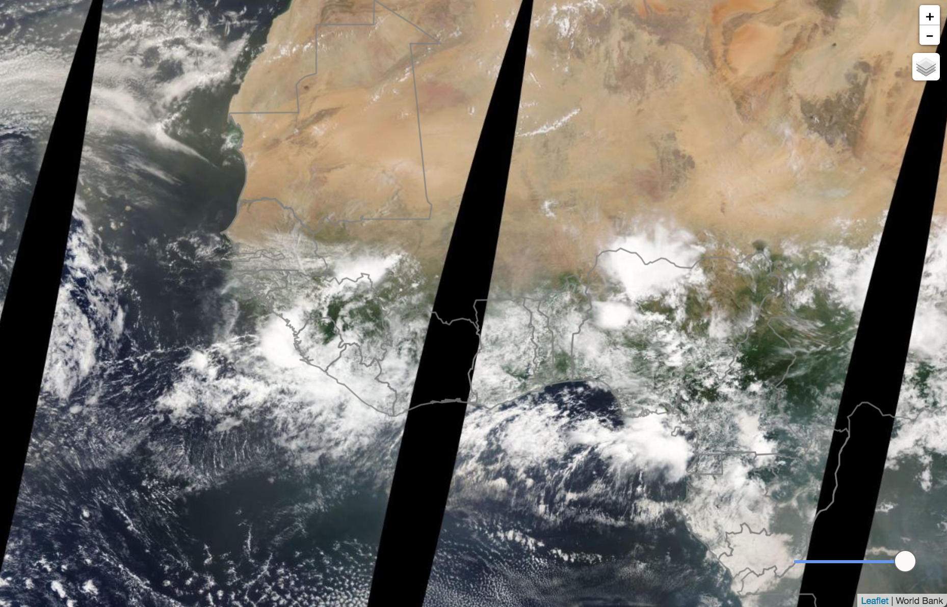
NASA Land Surface Reflectance
Climate Stations
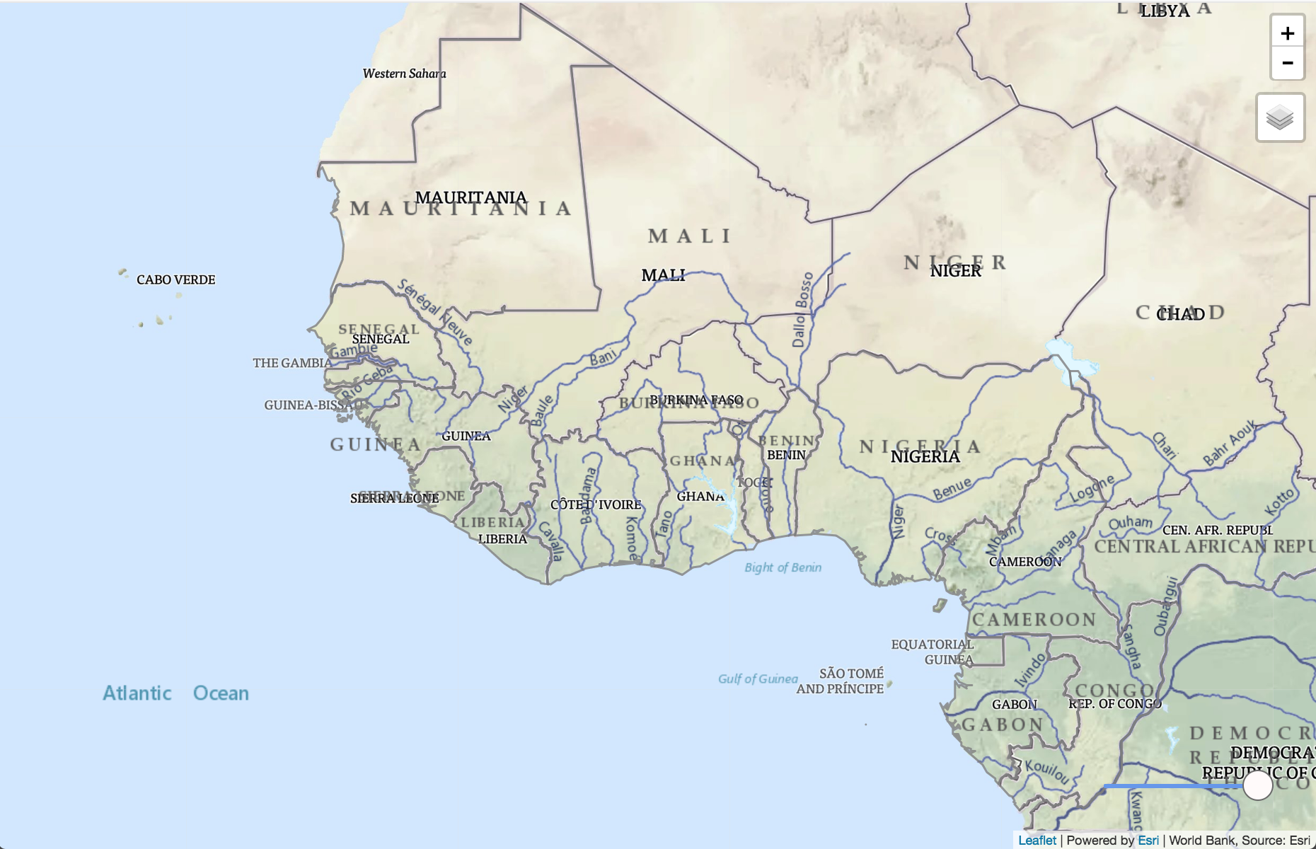
Hydrosheds (Rivers)
Basins
Maximum Soil Moisture
Available Water
Annual Evapotranspiration
Grace: Water Equivalent Height
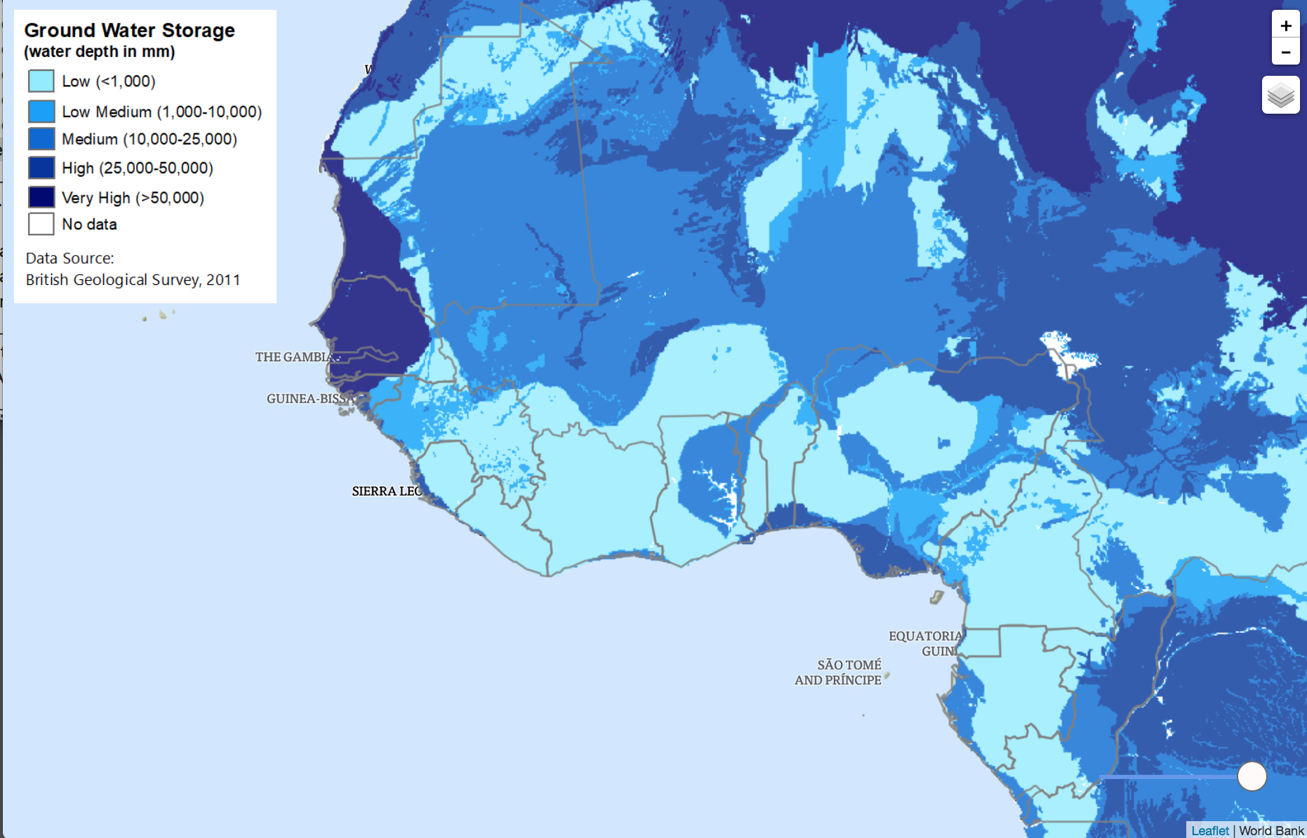
Groundwater Storage
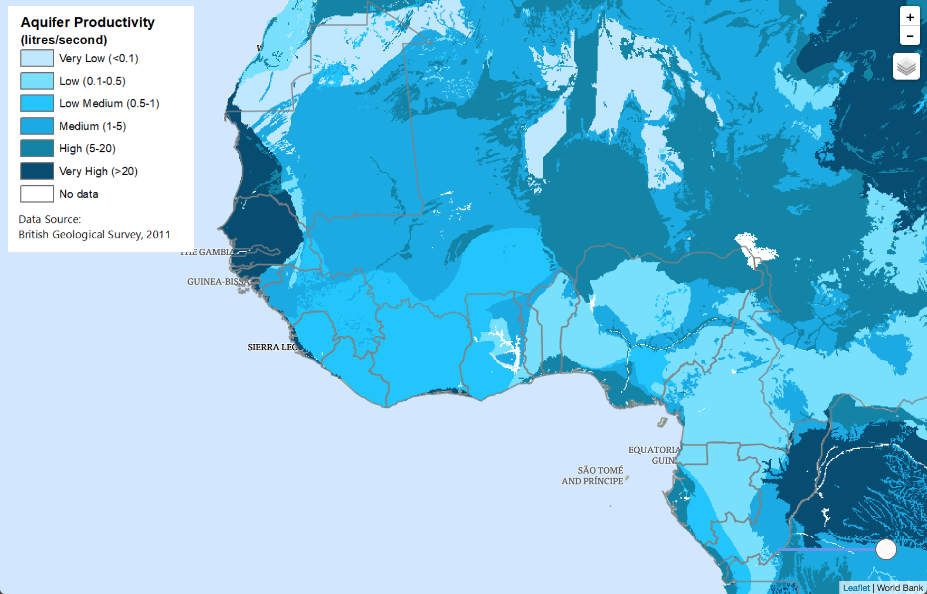
Groundwater Productivity
Productivity With Aquifer Outline
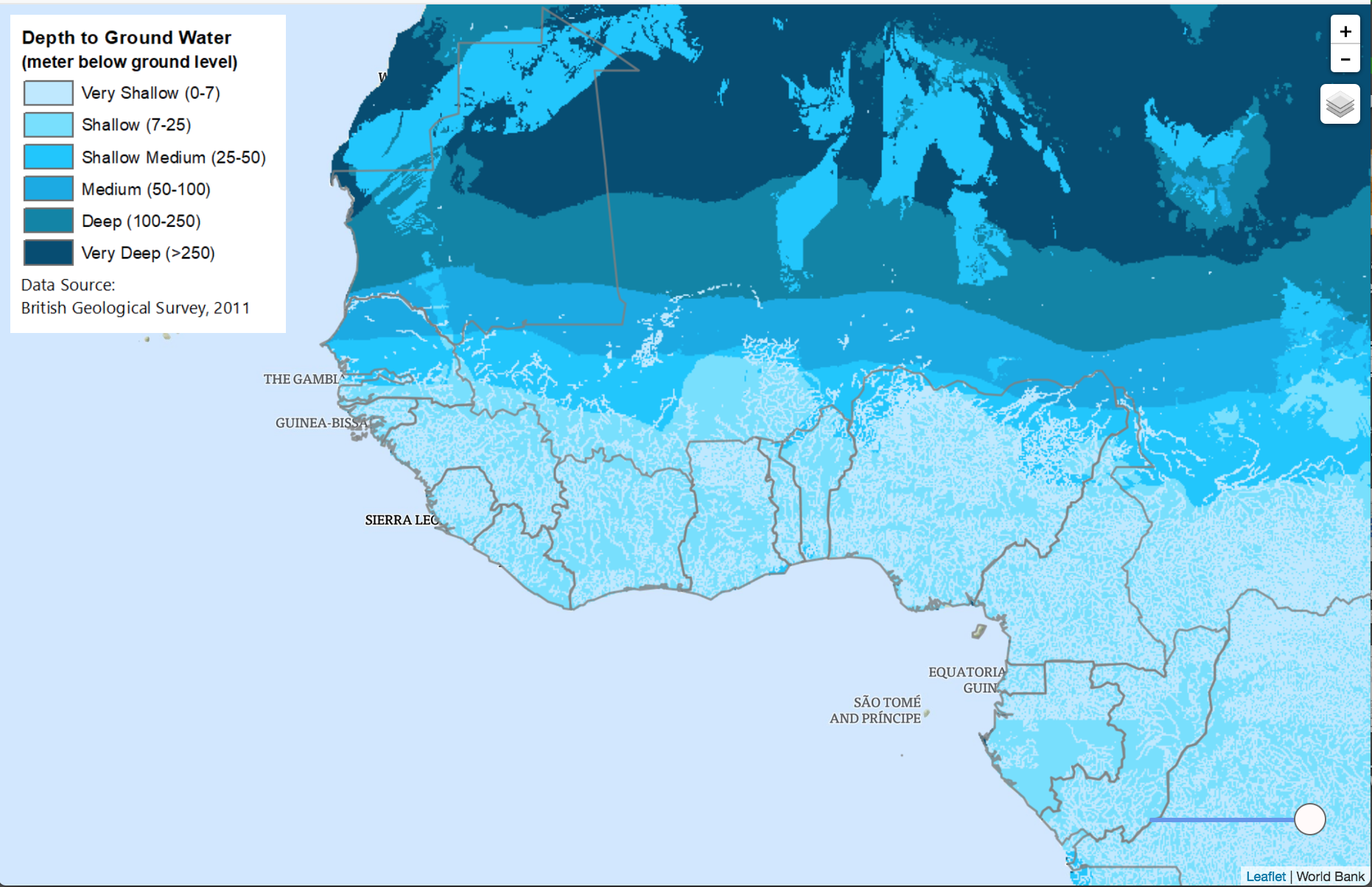
Depth to Groundwater
Africa Water Portal
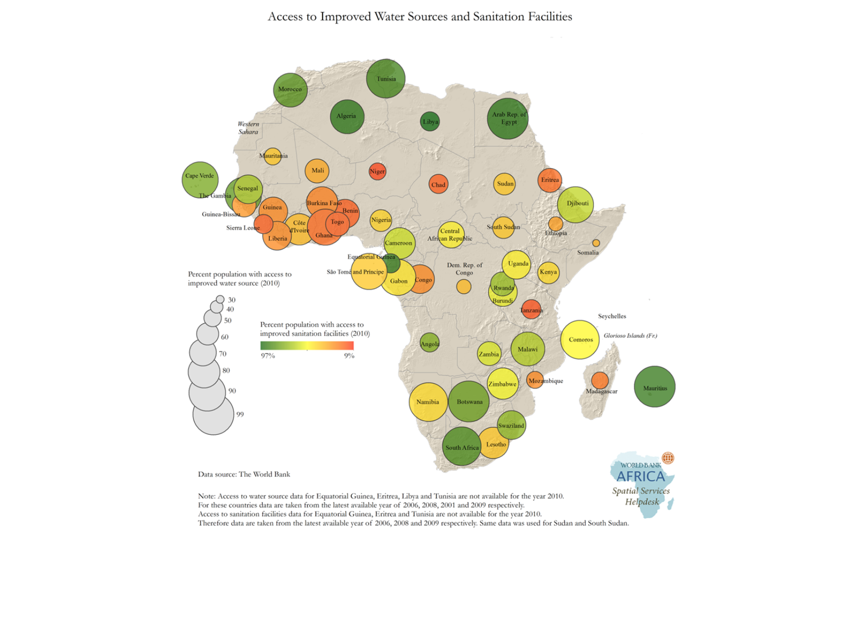
Water Supply
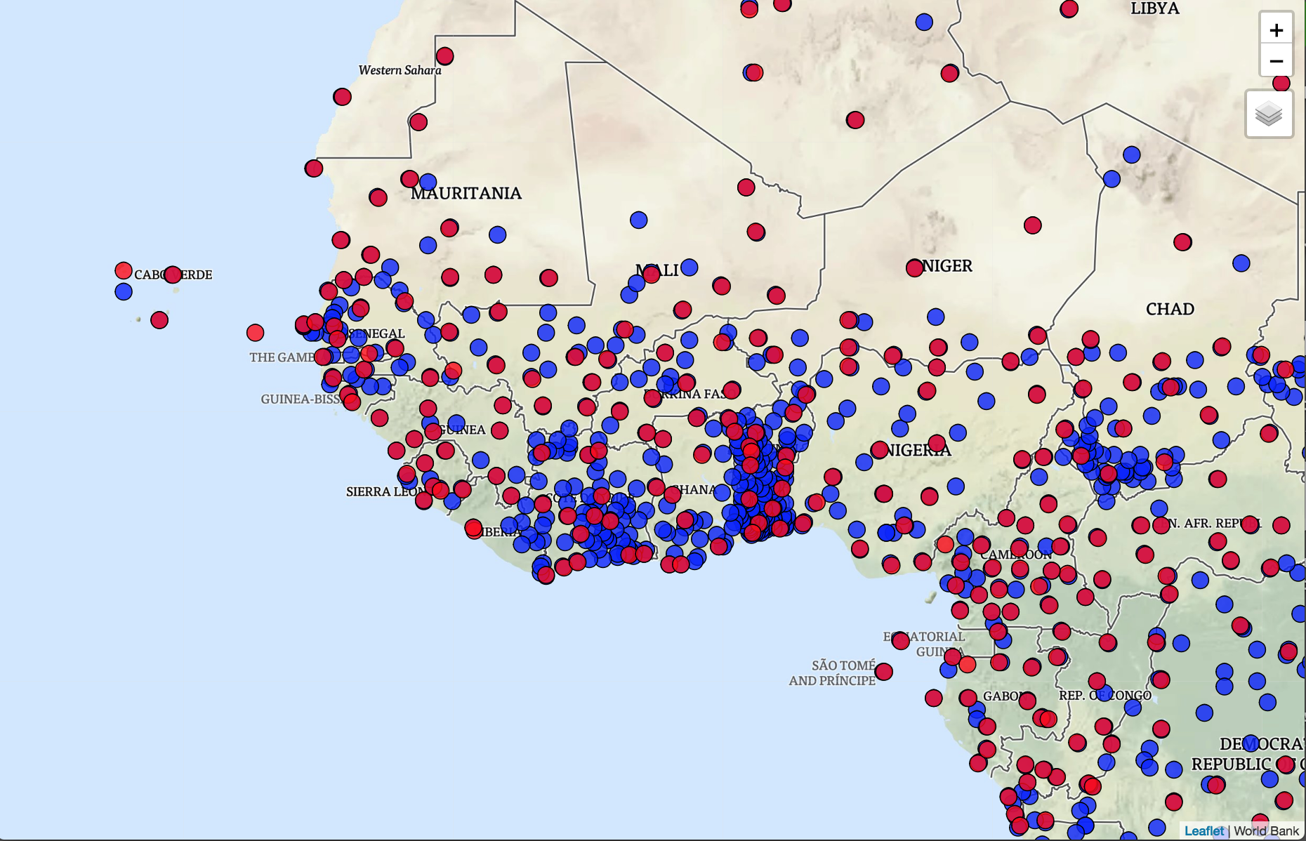
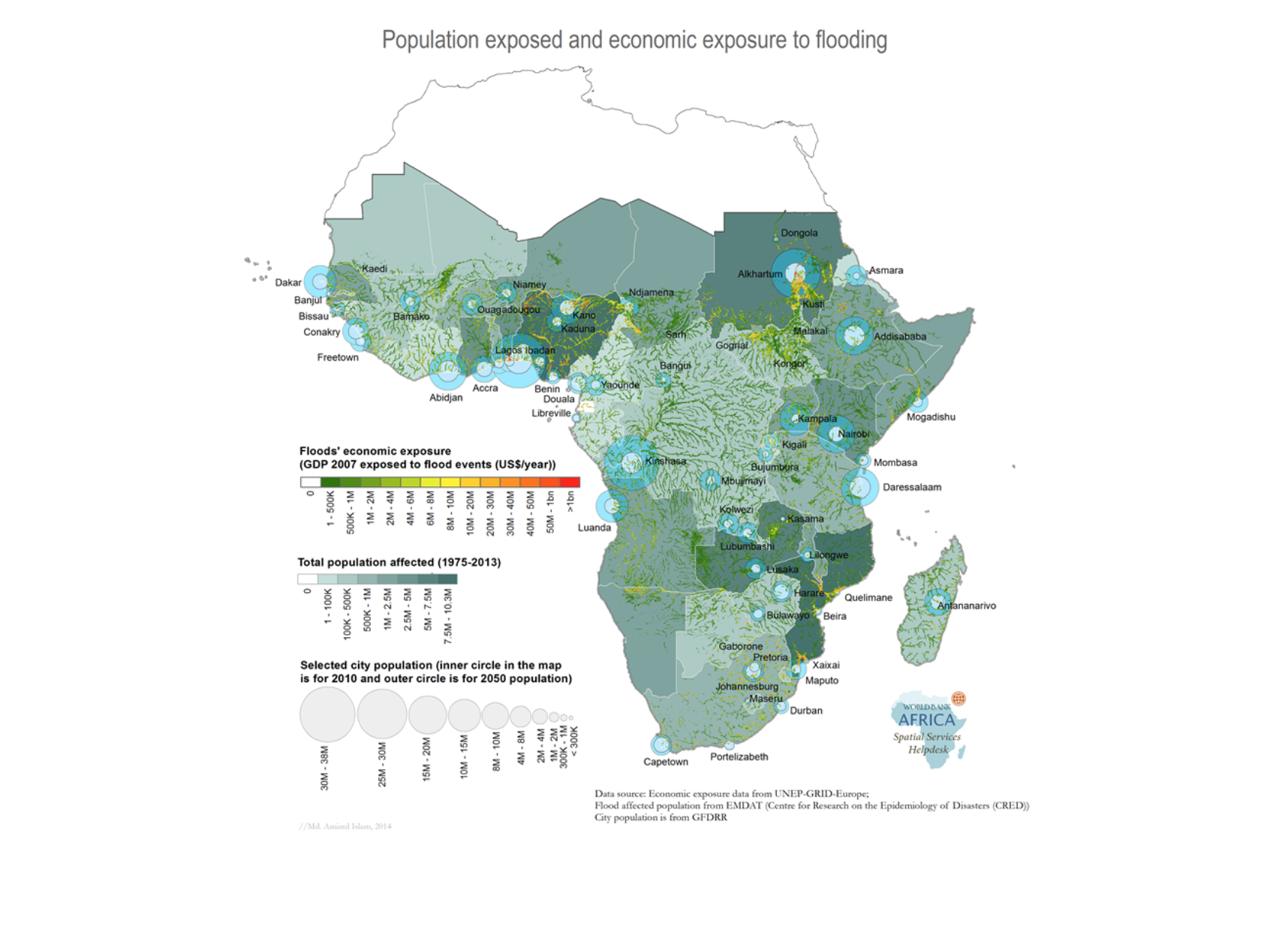
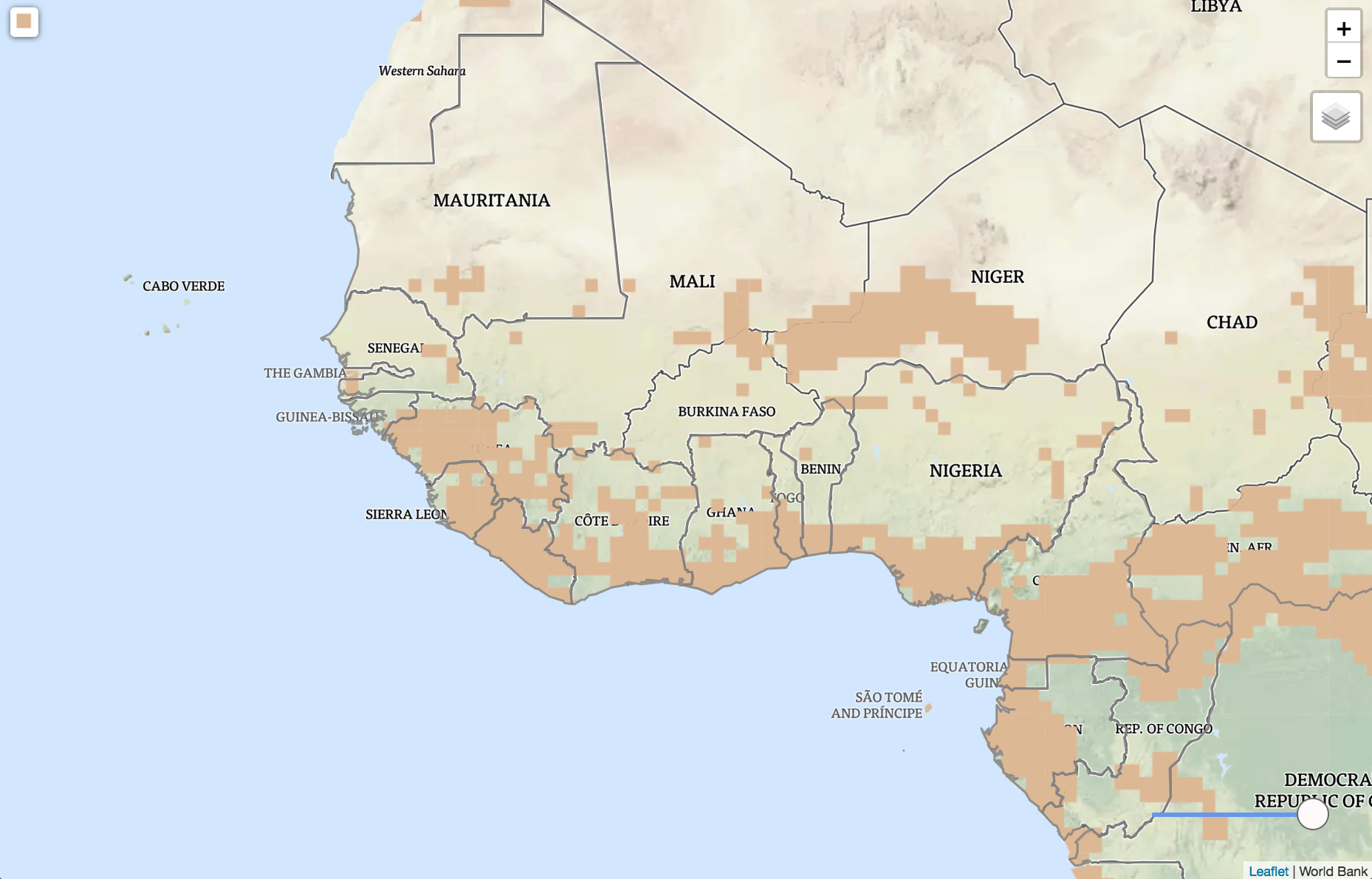
Floods
Flood Events
Flood Exposure
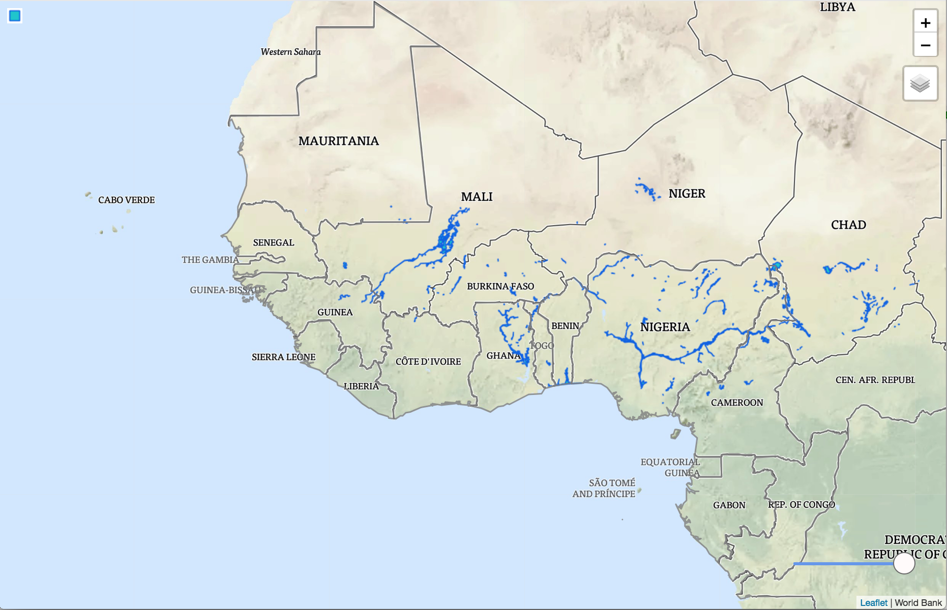
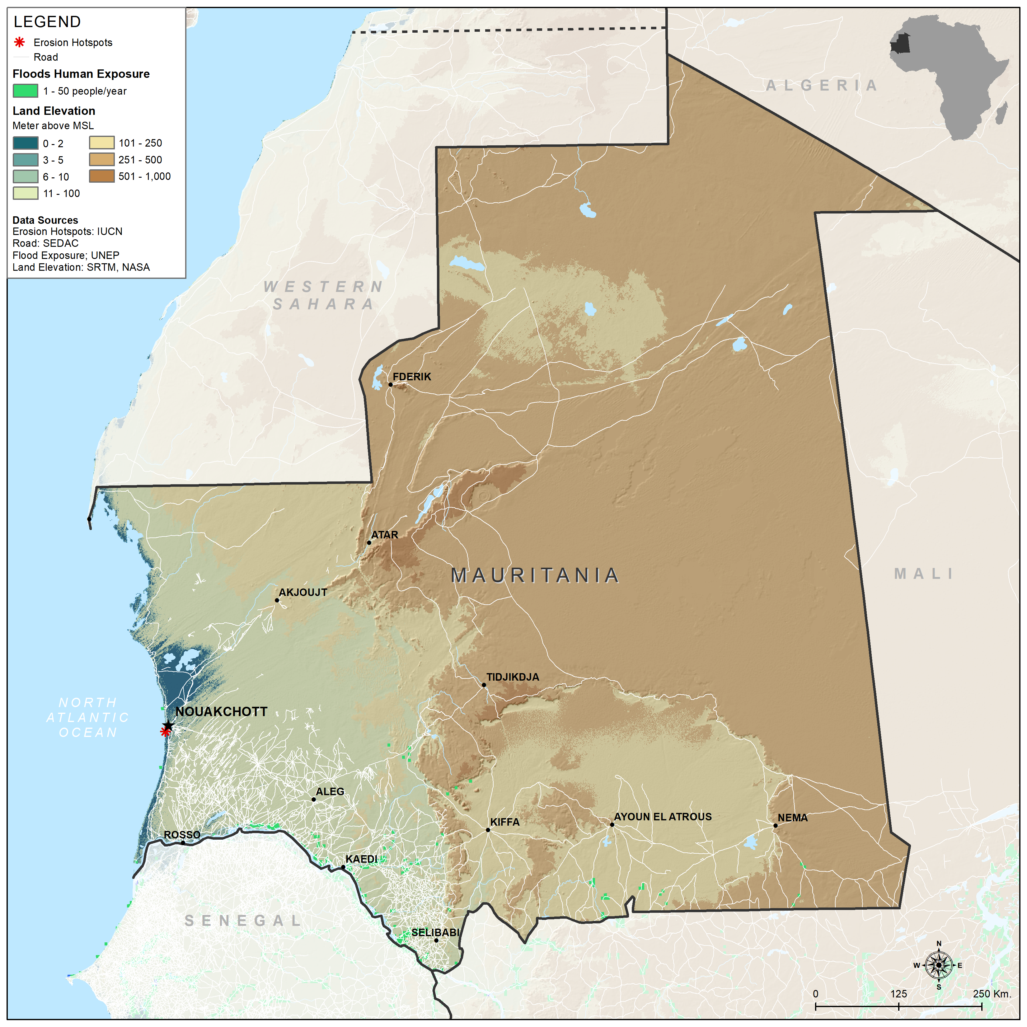
Flood Exposure Mauritania
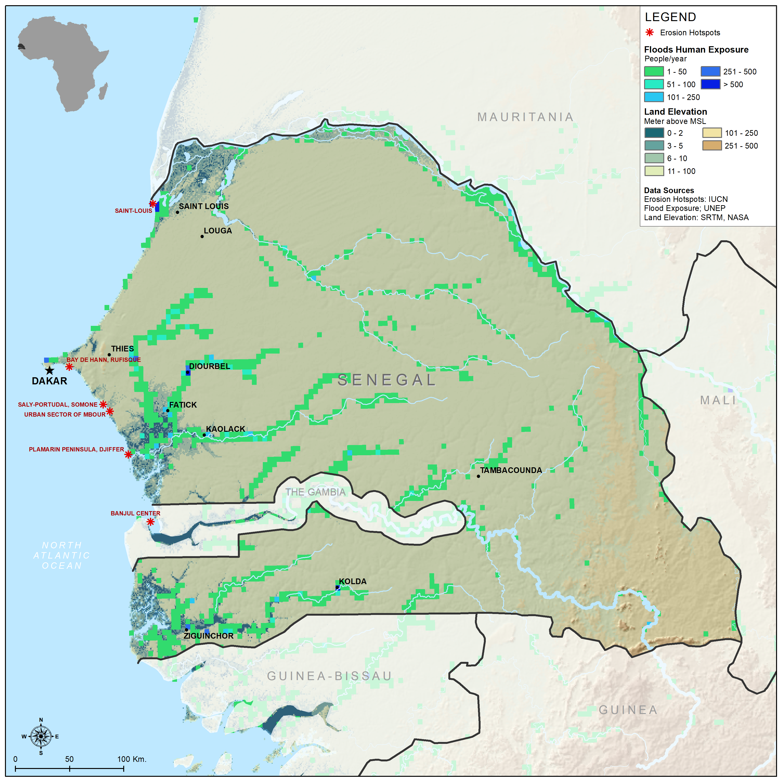
Flood Exposure Senegal
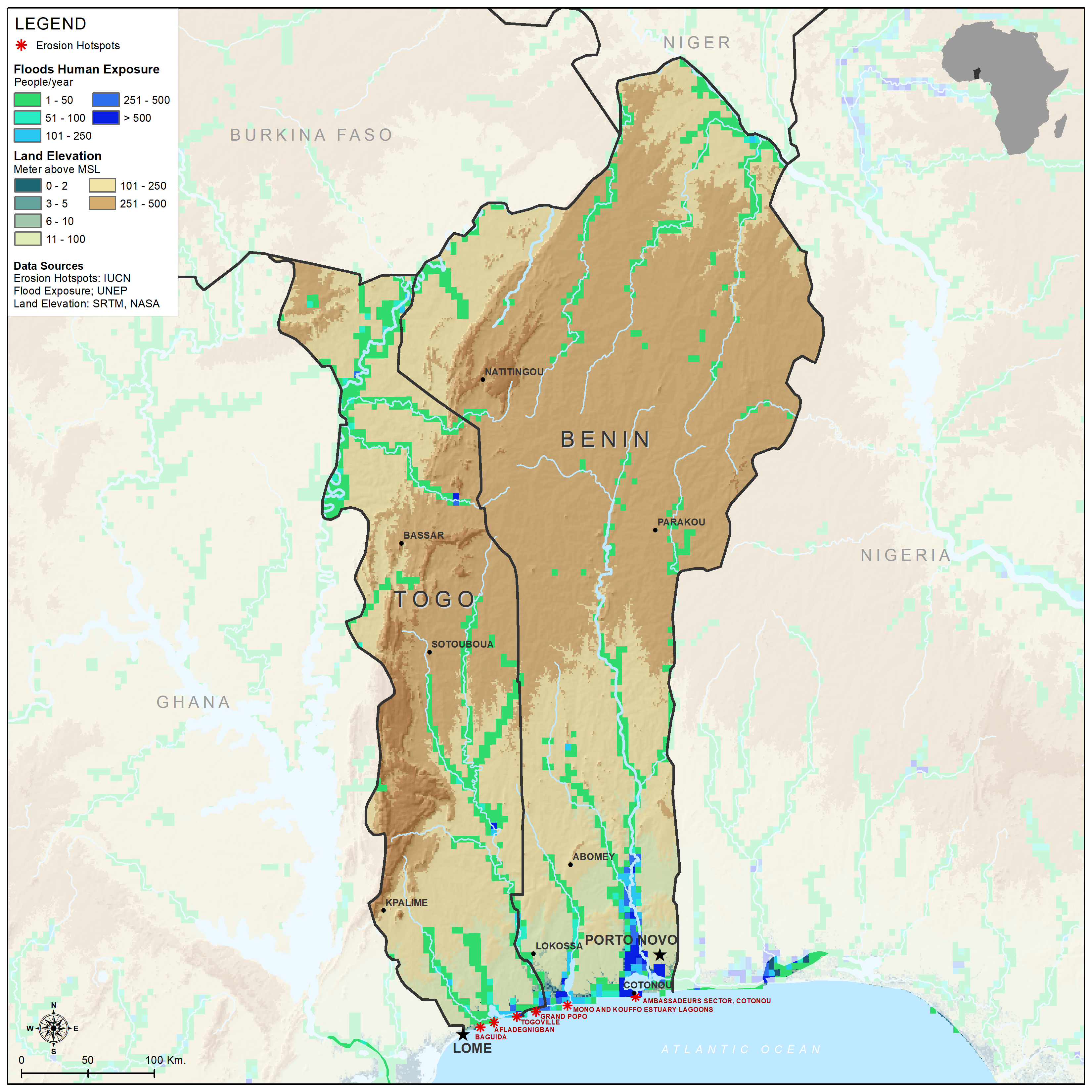
Flood Exposure Togo and Benin
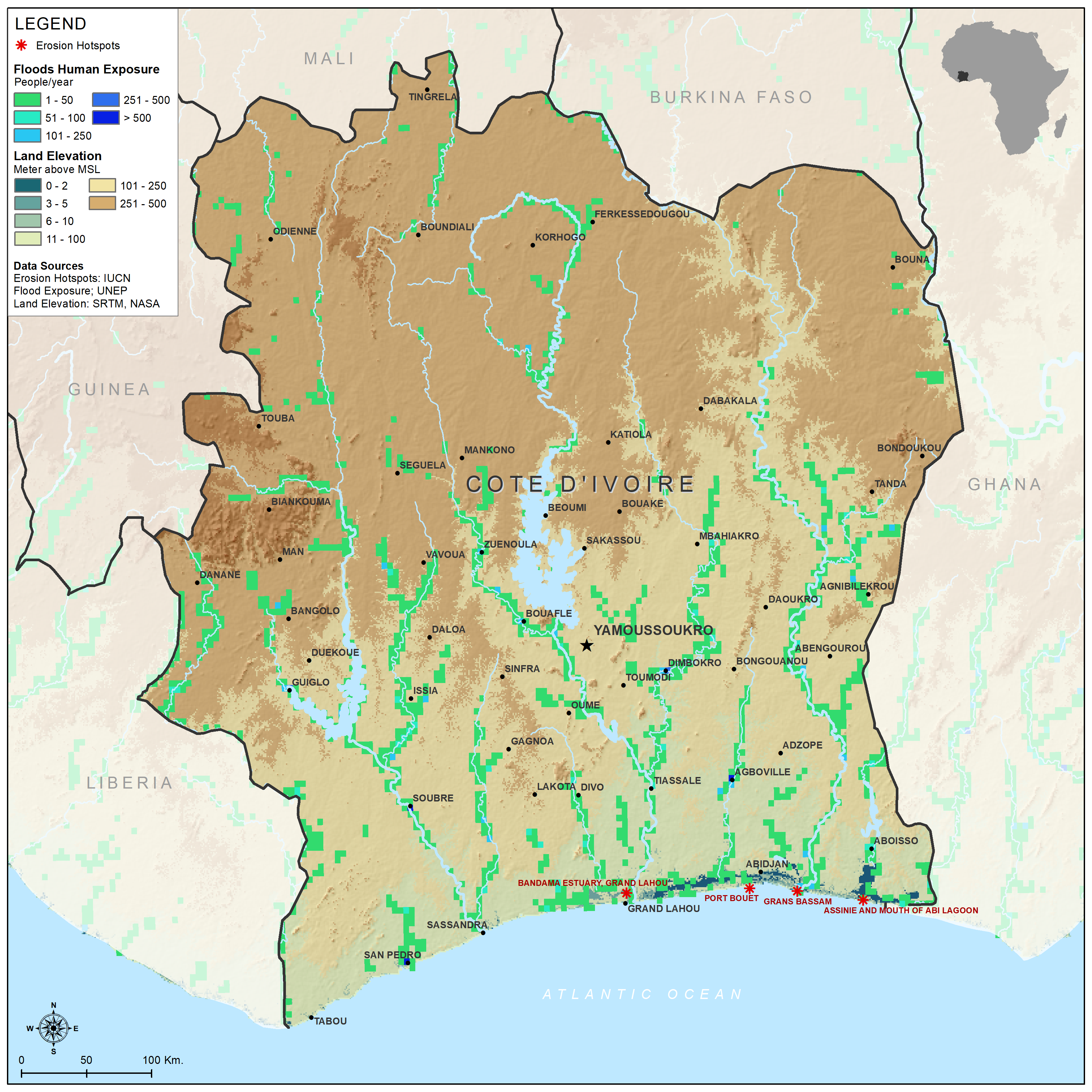
Flood Exposure Cote d'Ivoire
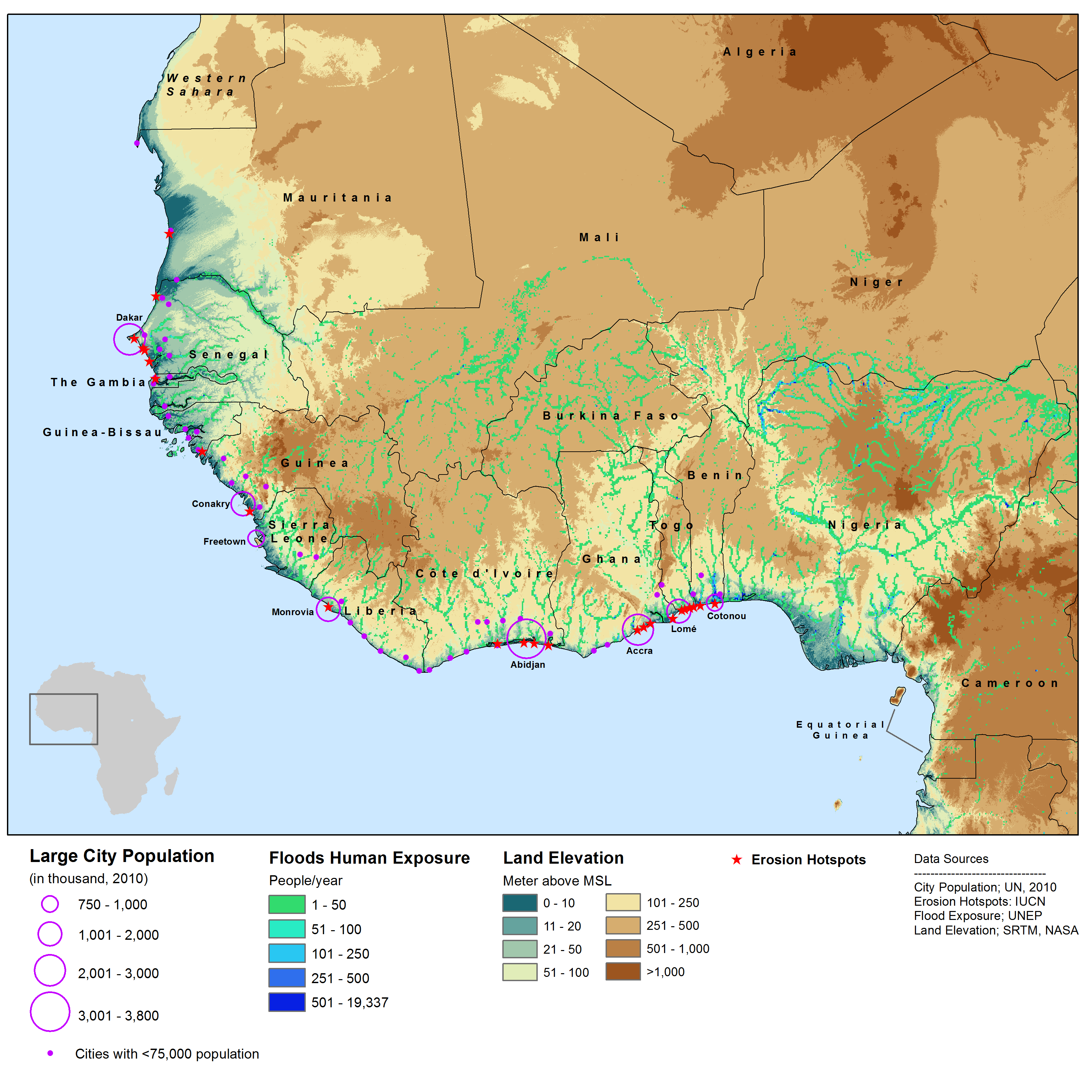
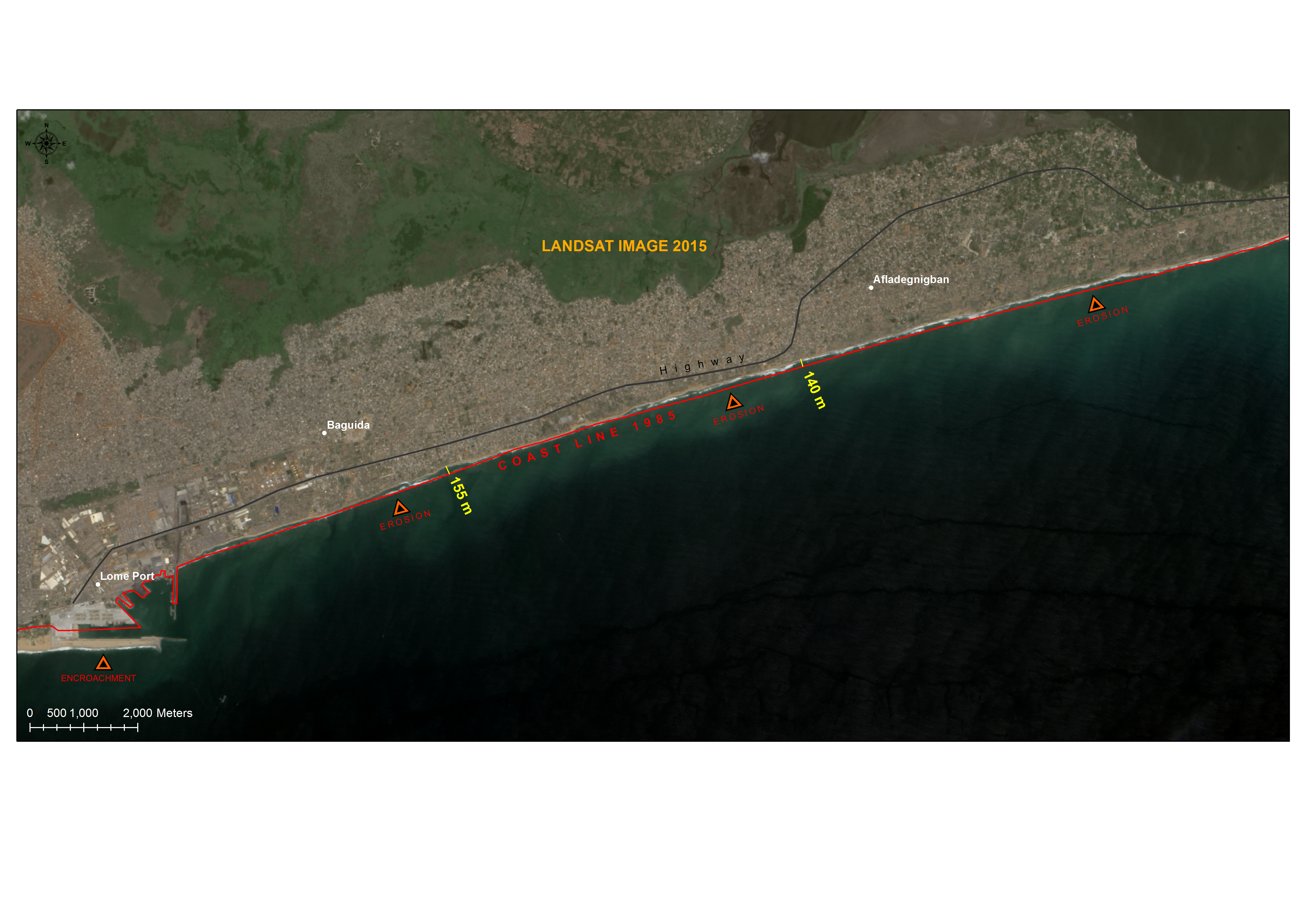
Coastal Erosion Togo
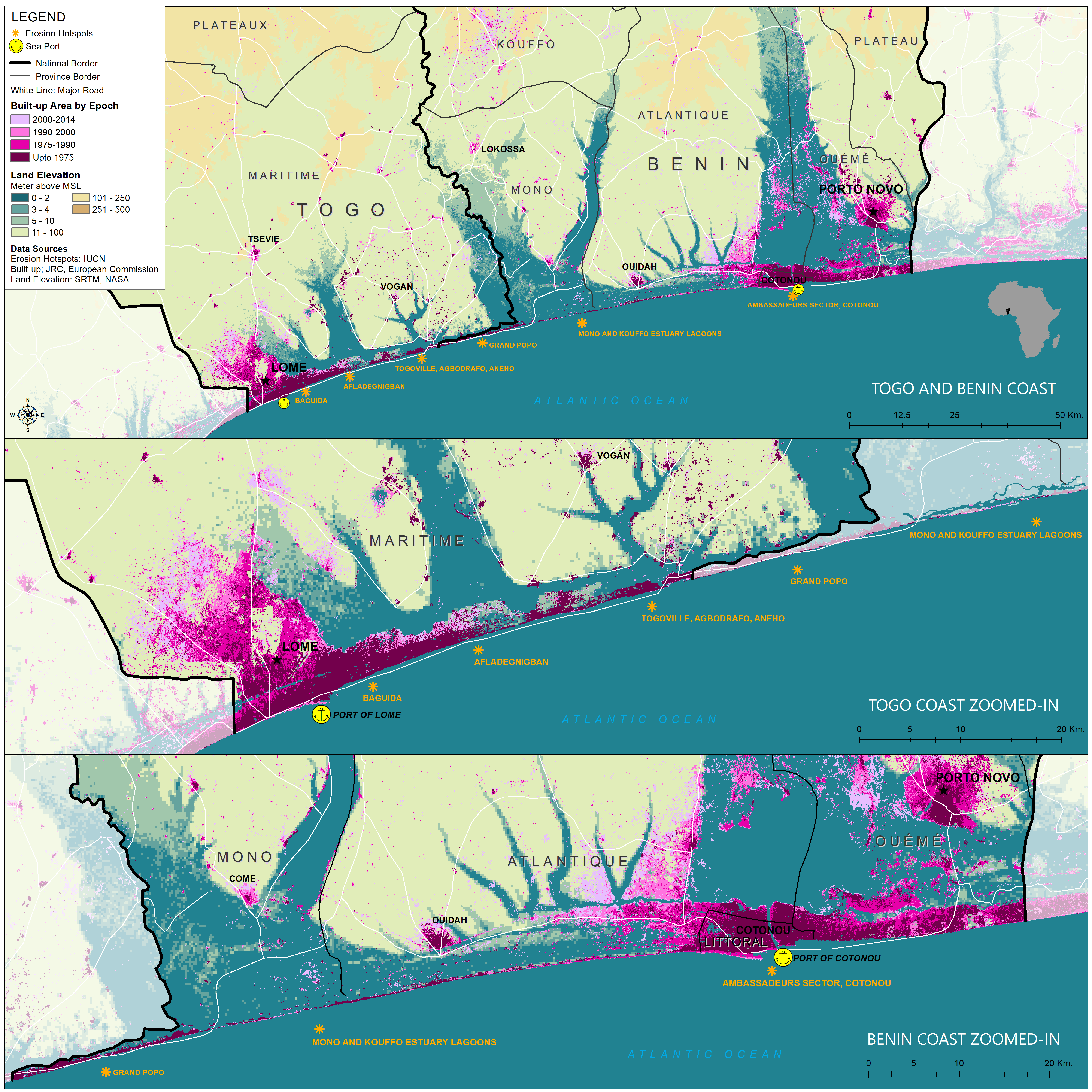
Builtup Benin/Togo
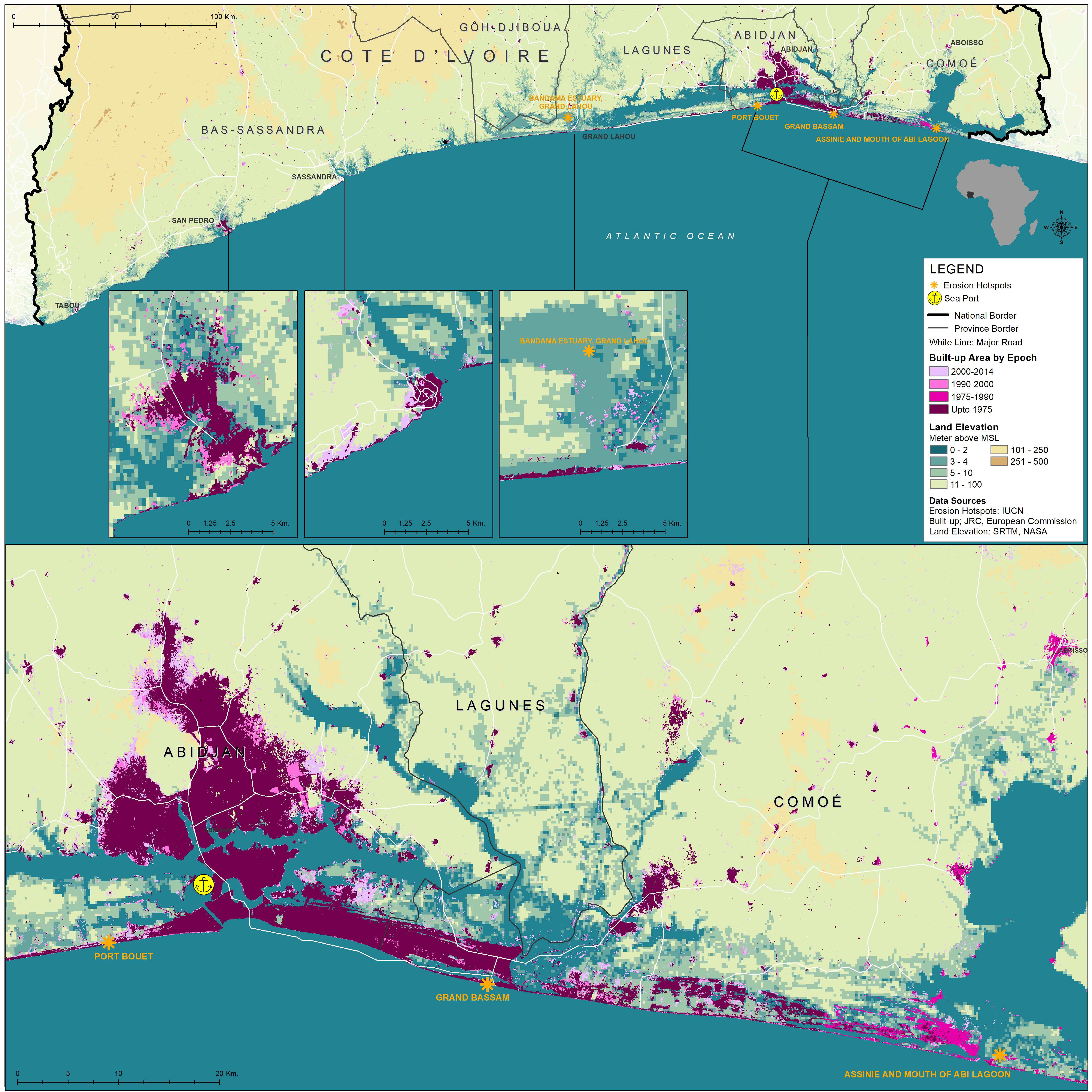
Builtup Cote d'Ivoire
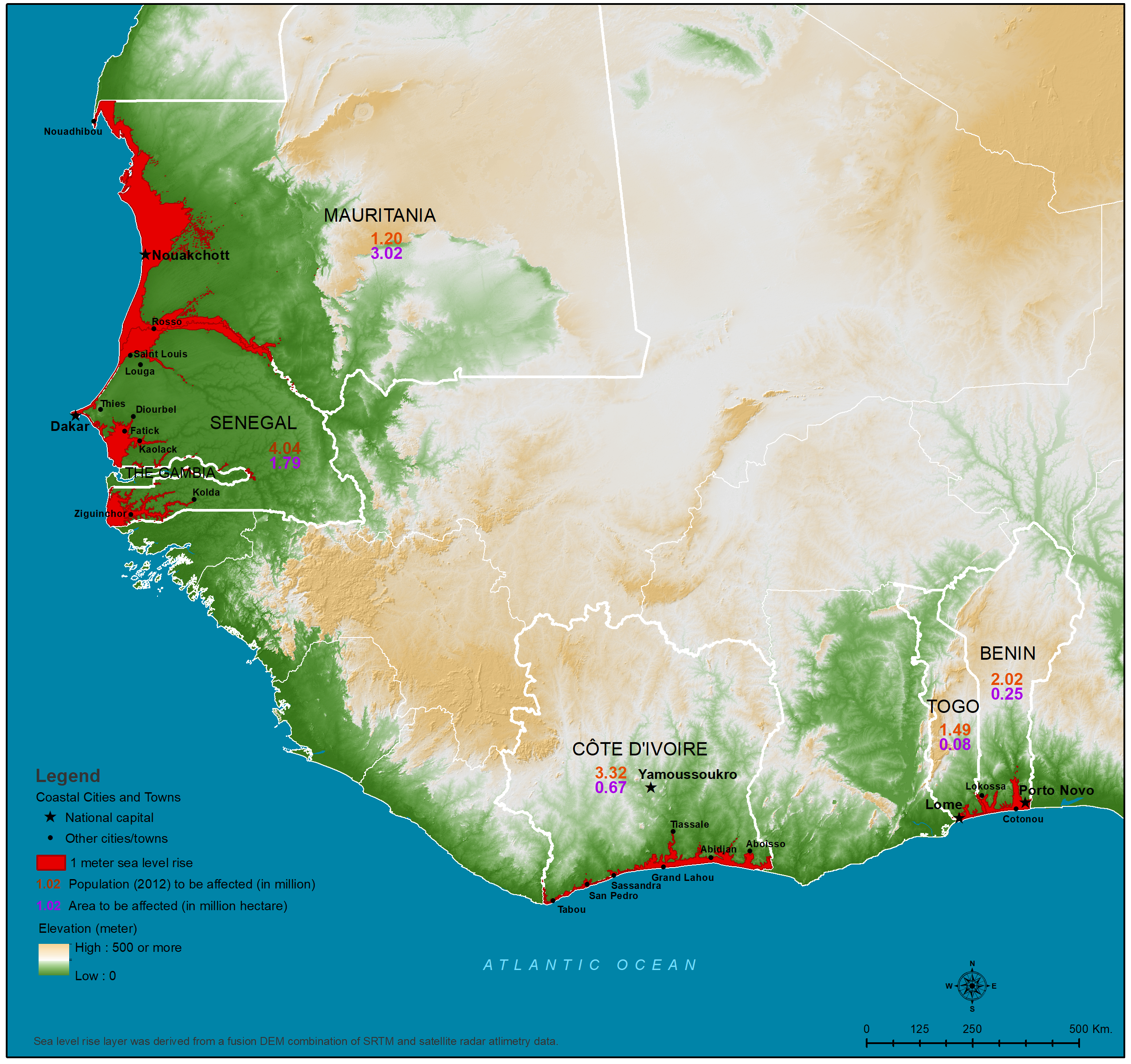
Sea Level Rise
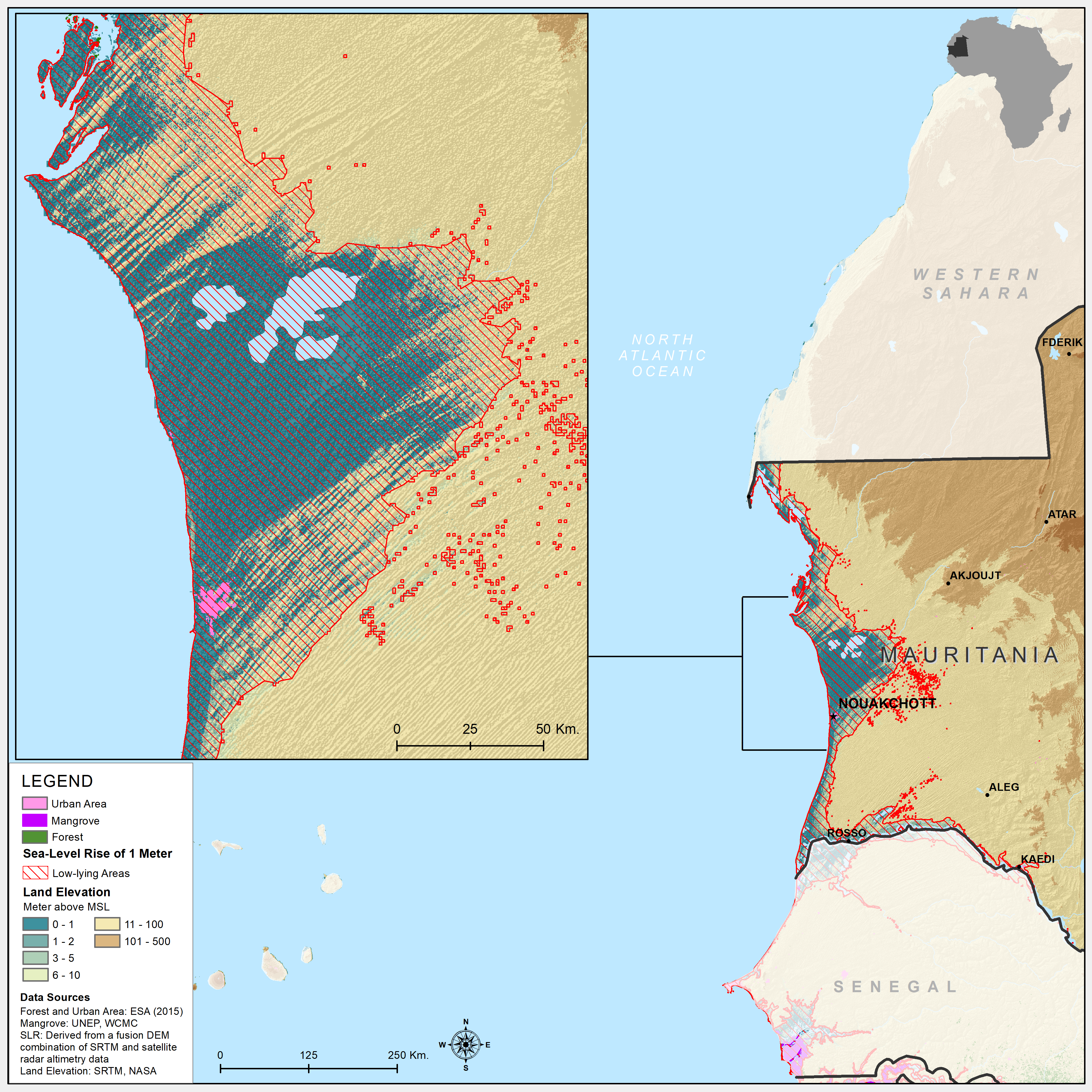
Sea Level Rise Mauritania
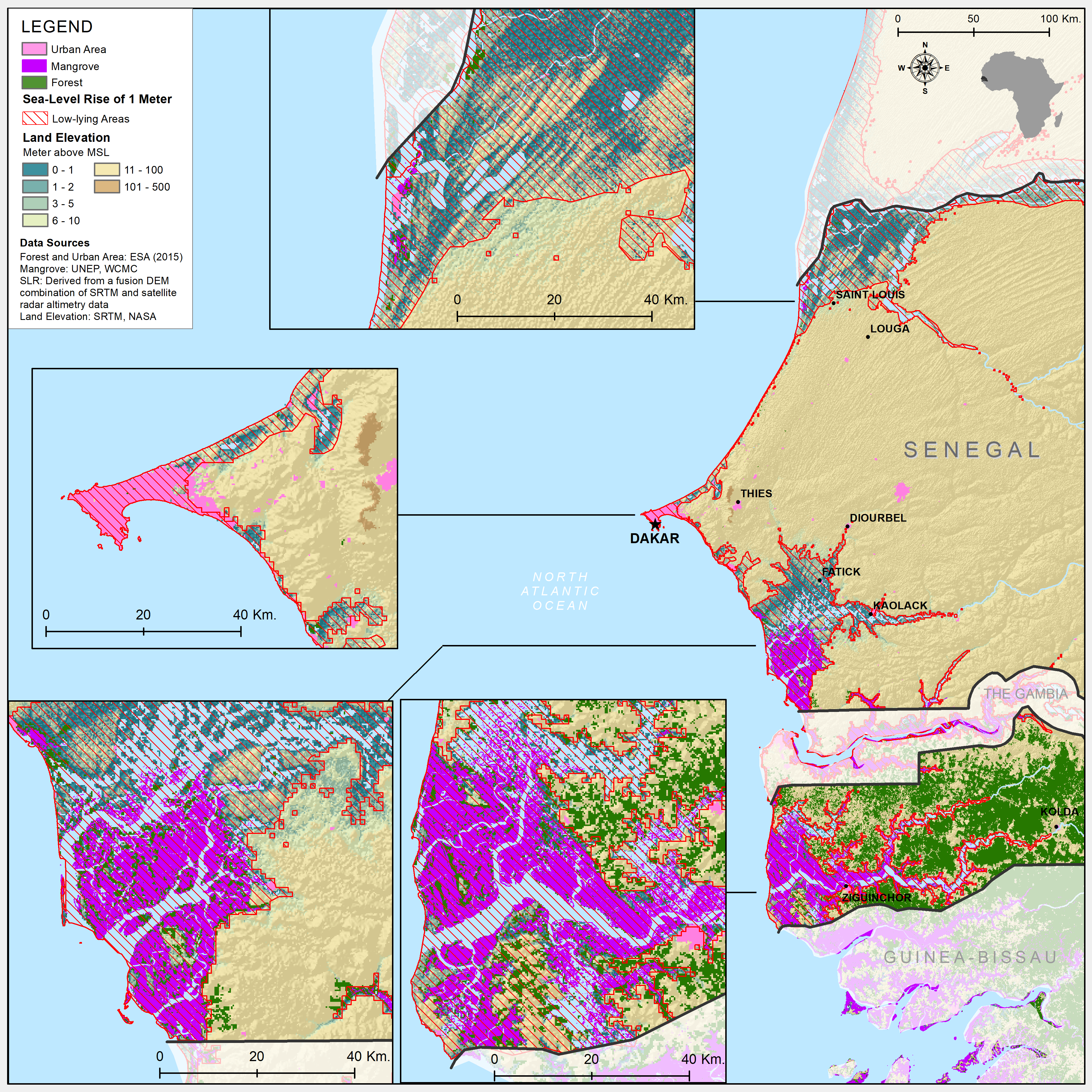
Sea Level Rise Senegal
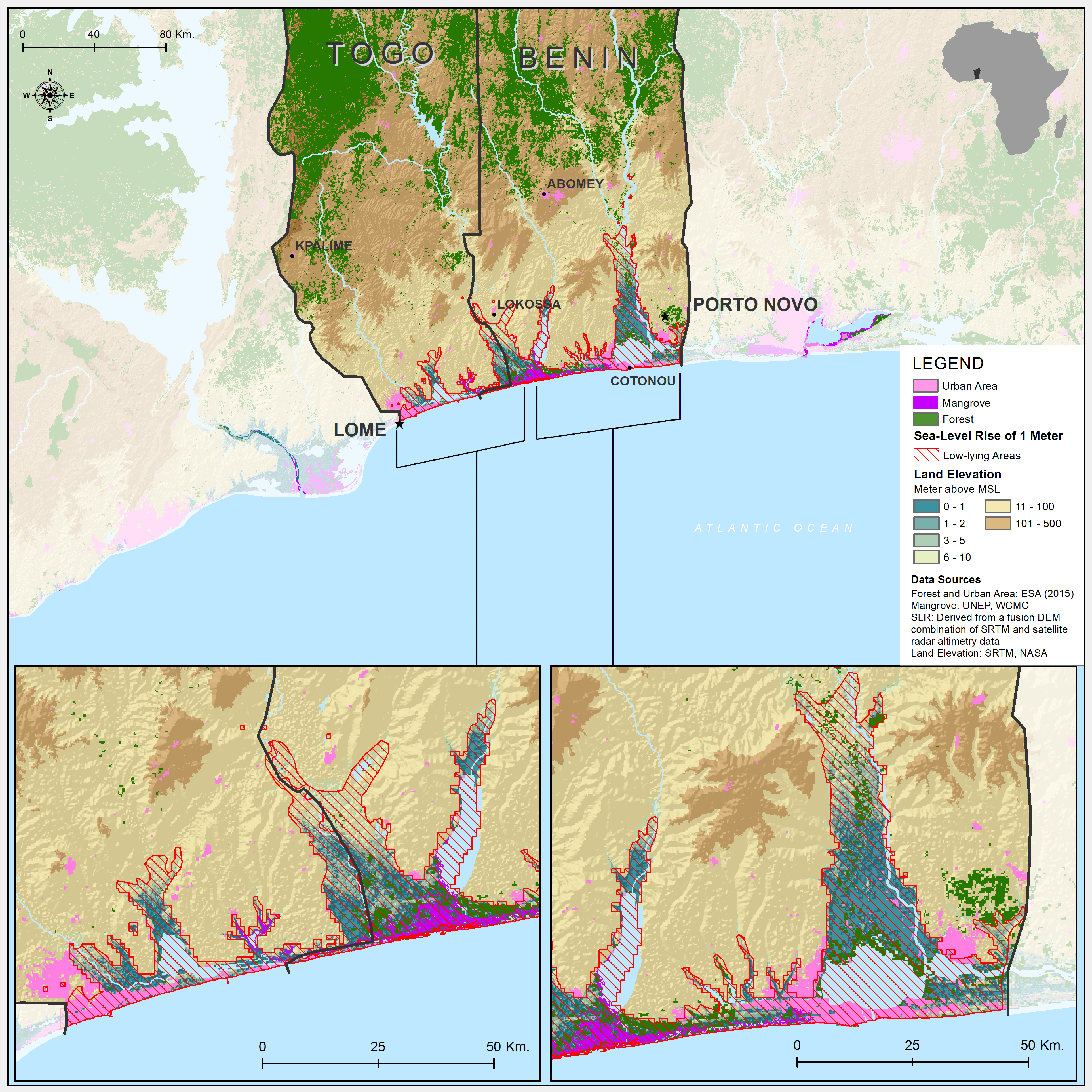
Sea Level Rise Togo/Benin
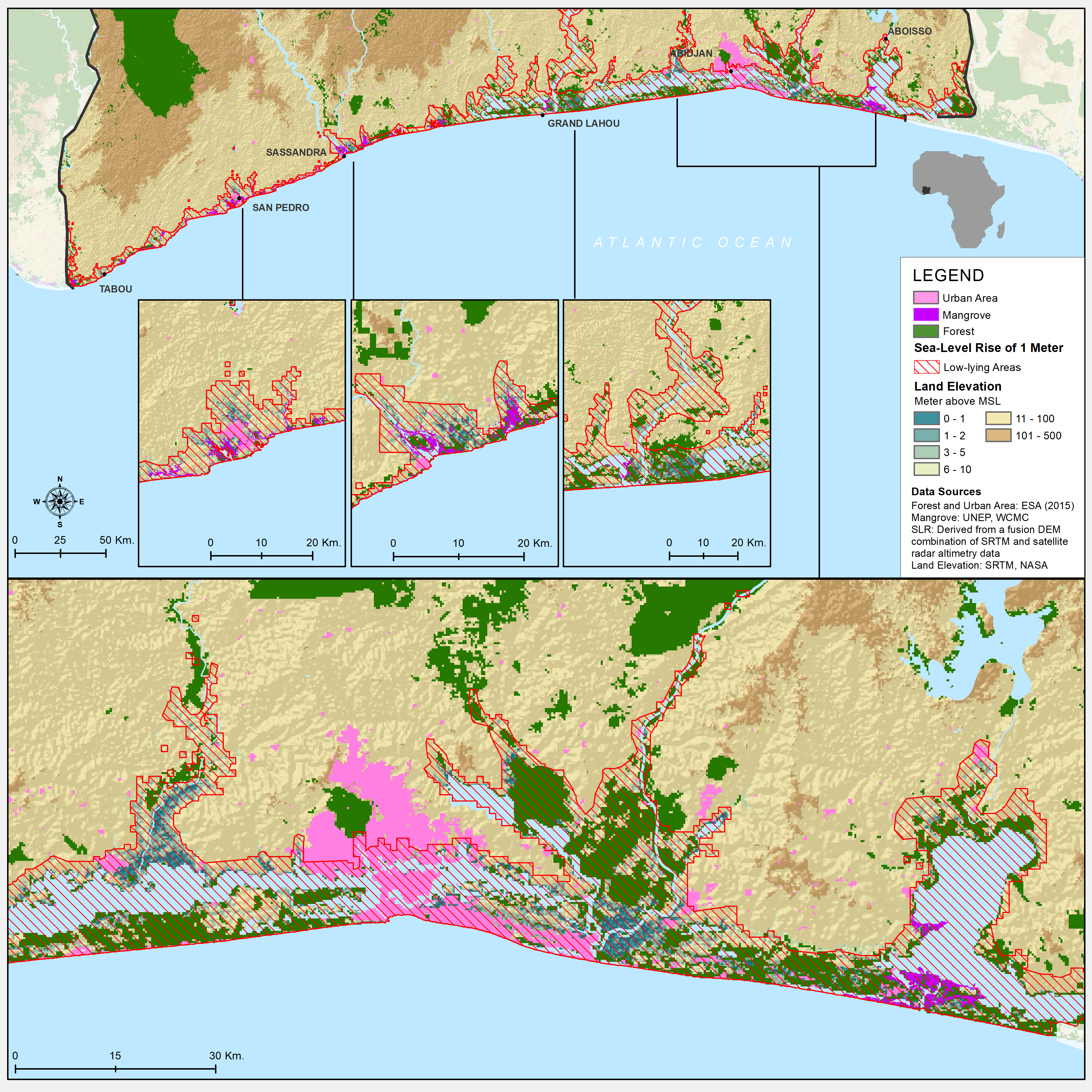
Sea Level Rise Cote d'Ivoire
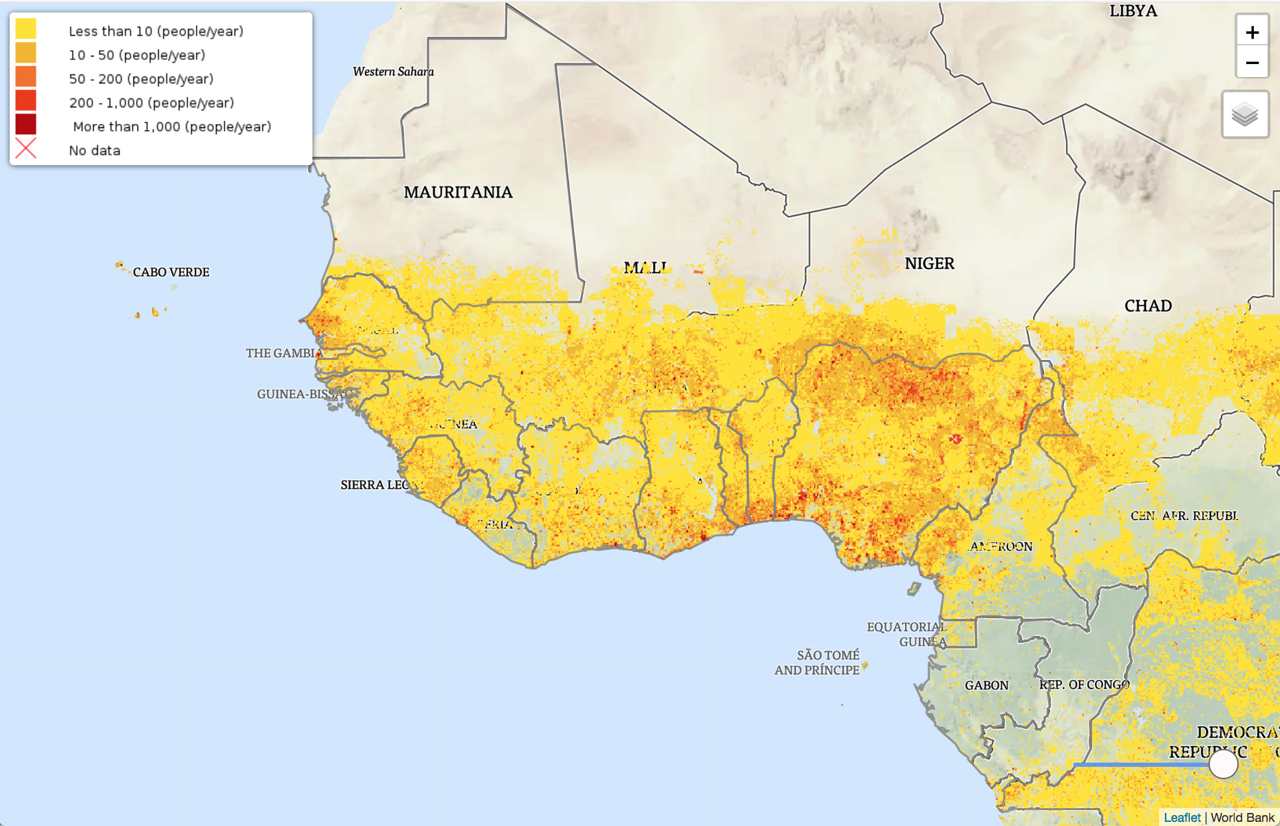
Drought Events
Drought Exposure
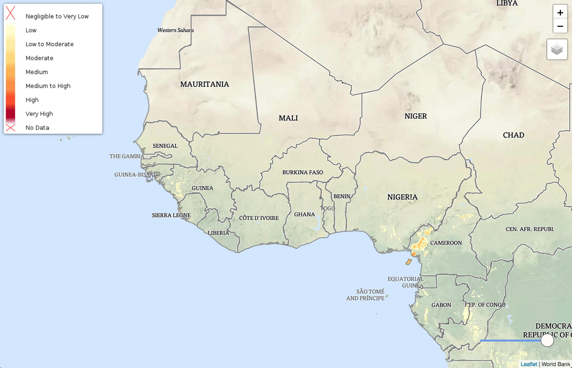
Landslides