Introduction - Hurricane Irma Recovery Context
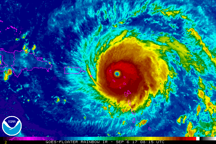
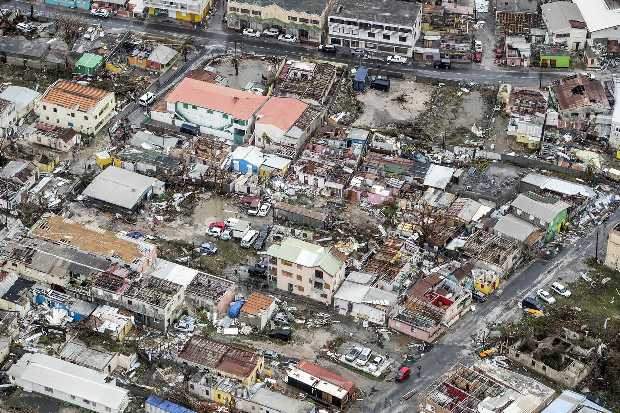
The World Bank initiated assistance to the GoSM in early 2018 after Hurricane Irma, a category 5 hurricane, hit the island in September 2017, leaving a trail of devastation throughout the country. Irma was shortly followed by hurricane Maria later that month further damaging the country’s infrastructure. The World Bank estimated damages and losses related to Hurricane Irma at US$ 1.38 billion and US$ 1.35 billion (both about 129 percent of GDP), respectively, affecting 90 percent of all infrastructure and large parts of the natural environment.
The tourism sector suffered significant damage. The airport was closed and required complete interior demolition and rebuilding. Hotels, guest houses, and tour operator vehicles and support equipment experienced total or significant damage and losses. Simpson Bay Lagoon became a graveyard of destroyed and sunken vessels. Land based and cruise ship tourist arrivals were dramatically reduced. All levels of island enterprises (MSMEs) experienced significant financial losses. Damages to homes, business offices and food establishments catering to locals and tourists experienced were destroyed or heavily damaged. After two years, SXM economic recovery and reconstruction continues to move along slowly.


To support the SXM recovery efforts, the Government of Netherlands established a US$ 553 million Single Donor Trust Fund (SDTF) managed by the World Bank. The SDTF financed selected activities in support of recovery, reconstruction, and resilience under the framework of the Sint Maarten’s National Recovery and Resilience Plan (NRRP), which outlines the country’s recovery needs. The STDF is also mandated to provide short, medium, and long-term recovery projects as well as required capacity building activities.
The National Recovery and Resilience Plan (NRRP) identifies the recovery needs across the economy, the community and the Government infrastructure and service delivery of the country. The NRRP outlines the Government’s vision, principles, and a proposed approach for rebuilding a “better and stronger Sint Maarten” following the “Build Back Better” principle. These World Bank supported activities also contribute to increased preparedness and institutional strengthening for climate variability and climate change by strengthening climate adaptation through risk management and reduction/preparedness.
One of the Bank’s commitment to the NRRP is undertaking a Country Environmental and Social Analysis (CEA). This product is an Interactive e-Book which is referred to as the Sint Maarten e-CEA. This CEA both portrays and integrates a collection of information and data to develop an approach for Environmental Priorities and Strategic Options for the National Recovery and Resilience Plan. This CEA also provides the GoSM with critical information to (i) map stakeholders; (ii) identify key near term and longer term environmental and social issues to be considered in SXM’s recovery plan; (iii) provide a framework that prioritizes these issues aligned with cost benefit outcomes across key sectors and (iv) provide options for potential sources of funding and implementation scenarios with a focus on GoSM improvements for environmental planning, regulation, and land and coastal/marine resources all within the context of climate change adaptation and risk management.
Since the island of Saint Martin is relatively small, addressing environmental issues is based on a three tiered approach, (i) focusing on the southern Dutch side; (ii) presenting island wide information on ecosystems and biodiversity, and (iii) considering the broader Anguilla Bank that includes the adjacent islands of Anguilla, St. Barts, Saba and the smaller nearby islets. The main focus of this document however, features the Dutch side.
The following two maps focus on Cole Bay and Philipsburg and show the impact of Hurricane Irma on these locations. The interactive maps display the extent of damage to individual buildings from the Hurricane. Dropdown choices allow for also displaying the type of building (e.g. residential, industrial) and the type of basemap (e.g. basic World Bank basemap service, imagery). The map can be zoomed in (e.g. using the +/- on the top left of the map, using the mouse scrollbar on a computer, or “pinching” touchscreens or smartphones/tablets).